My brother and I are twins, born 5 years apart. I feel like we couldn’t be more similar while being entirely different.
He used to have jet black straight hair as a chubby child and could have been dropped in Mongolia without any natives questioning his locality. His facial features and naturally tanned medium skin color mixed with slightly slit dark eyes, framed by dark bushy brows, show a very strong far east genetic connection.
I, on the contrary, even tho also have straight hair, it used be so blond might as well could have been called white, when I was little. I was always on the skinny side with legs and arms for days, white skinned, with piercing blue eyes that shyly looked away from under invisible lashes and brows.
We were always good siblings. For the most. Him being my big, loving, protecting brother while I tried to cling on him like Velcro. Other times I was the typical annoying little sister throwing tantrums for no reason at all.
We both were naturally shy and reserved and making friends was never our forte. The few times in our life we had minor fallouts were all caused by people close to each of us.
While he lived overseas as a young adult I tried to fit in with my age group. Getting drunk every weekend or smoking my first cigarette in secrecy – after my ‘best friend’ trusted me to hold on to her pack while she was trying to quit – now doesn’t sound like a great way to make lifelong friends.
Even over the years while we lived thousands of miles apart we stayed connected, while not in the true sense of phone calls and such but definitely spiritually. He later told me all the crazy stories about what he had to go through to find his way.
I think we could write a book about our trials through both of our lives following a parallel timeline. What really kicked off all the ‘happenings’ was losing our father to cancer when I was a few days shy of turning 11.
Fast forward almost 40 years, where now I live overseas….
In April our mom got hospitalized from out of nowhere, our sibling bond kicked in yet again, driving us to come up with a solution for her. She has always been there for us. – I know, that’s what most moms do. – Providing the best for her is the only way, so we must cooperate in overdrive to achieve our goal.
A quick ‘tripod’ formed from out of necessity and we started working on a PC game that will blow the best ever selling game on this planet to pieces. Did I mention we are also very humble?
Of course you don’t believe me, you might even let a little tzk out but you also know that knowing if that cake is good, you must taste it!
(This is an analogy for a situation where the only way to know the final outcome is to experience it.)
So when you have a minute, just cope-paste this link below…. (WordPress doesn’t let me add a link)
I’ve been quiet for a while because Mag is aging, he cannot walk as far or as fast – except chasing groundhogs – as even a year ago.
We still walk twice a day but hiking would be just too much for him. He turned 9 in April! And for both of us the summer heat is a no go! And don’t even start with me on all the pesky bugs! We are both really looking forward to the cooler months. Aircon can be finally turned off, windows can be opened to enjoy the nice, fall breeze! Bring it on!
I also have had some personal reasons – Mag is the most personal reason, tho – that shifted my attention to other projects. We have moved from the city (Baltimore) to the quiet suburbs above Washington D.C. (waaay above) and between home projects, work, animals and my planned & unplanned travels ‘home’ fill my 32 hour/day days. I have no idea how people balance kids above all these things! I feel like a whiny little 💩, since I don’t even have children in the mix.
So anyway, unfortunately at the end of April my mom got hospitalized – from out of the blue – and that is now what I am mostly spending every waking hour with.
Figuring out a solution.
To get her out of the hospital and provide professional home care for her most likely for a year. It is costly even tho she lives in Eastern Europe. I have been selling everything of value, started a new gaming business with my brother, which pushed us to brush up on our social media skills and even started a fundraiser to benefit HER. All these new endeavors are exciting but not quick enough to help her immediately.
If YOU – I am already very grateful that you are reading this – would be so kind to read about her story on Kickstarter and if you feel it in your heart to support her cause I would be extremely appreciative! Also please SHARE this link everywhere you can:
We – Mag and I – still have our instagram @magzilla44 account for our funny dog and cat videos along with – mostly – insect vids. If you are interested in nature photography I still post on Flickr every once in a while under the name: Mag Zilla.
I thank you again for taking your time to stop by here and read about all that has been happening with us. Hope to see you around!
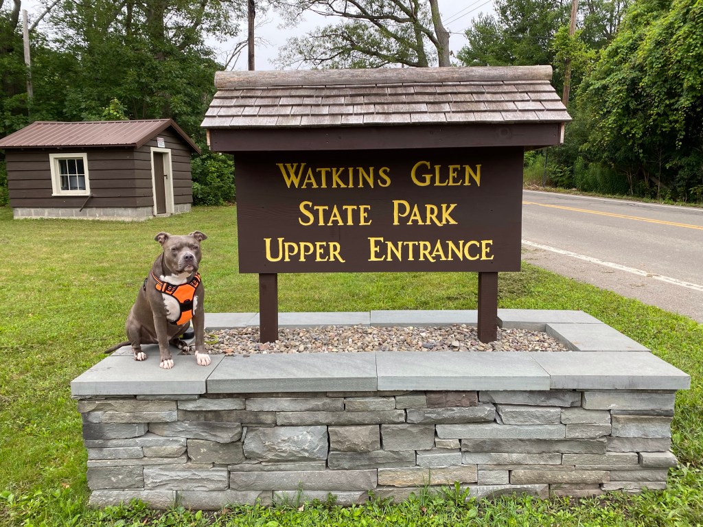
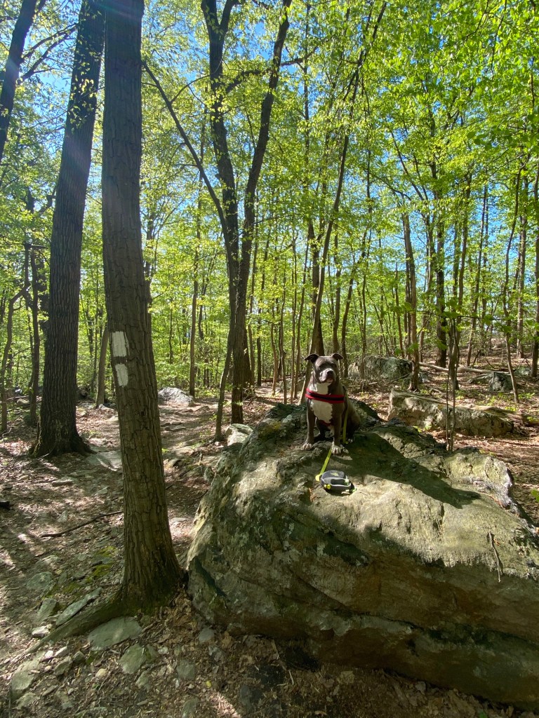
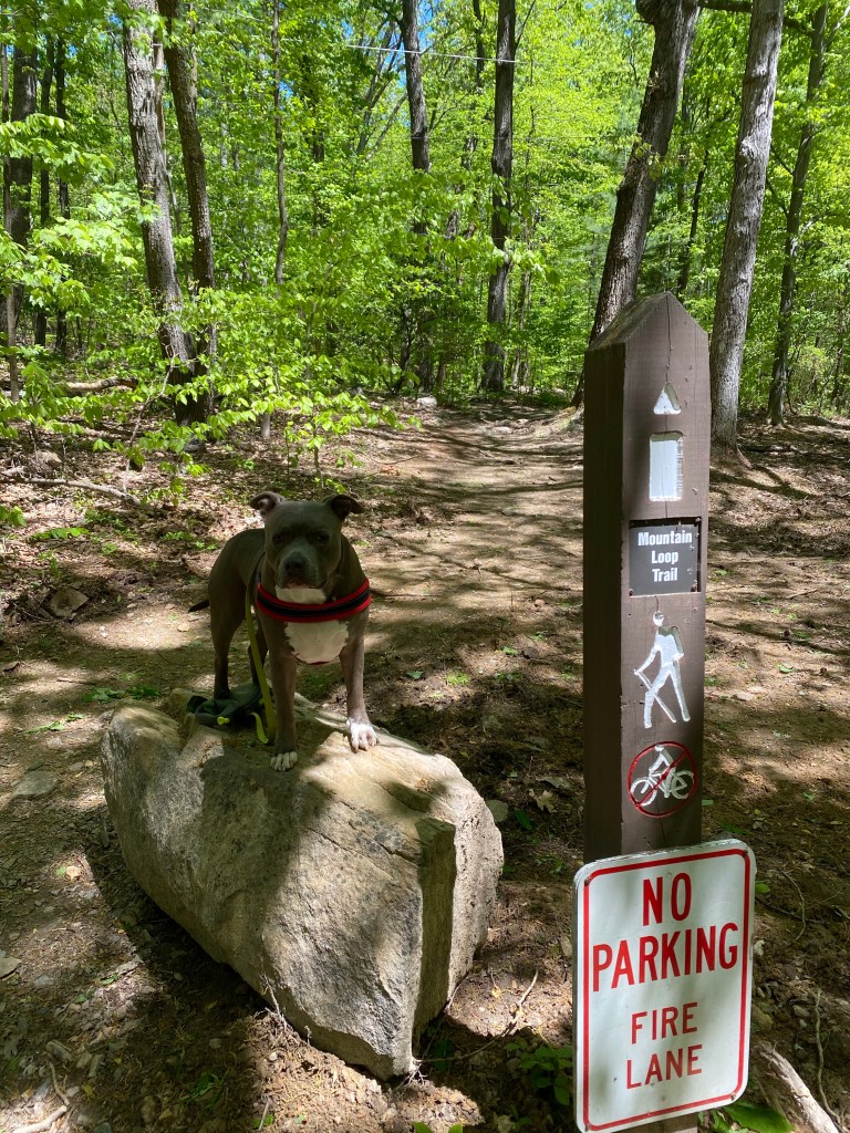
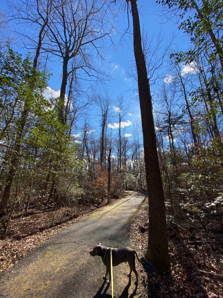
7/17/2021 Watkins Glen Upper Entrance – Indian Trail
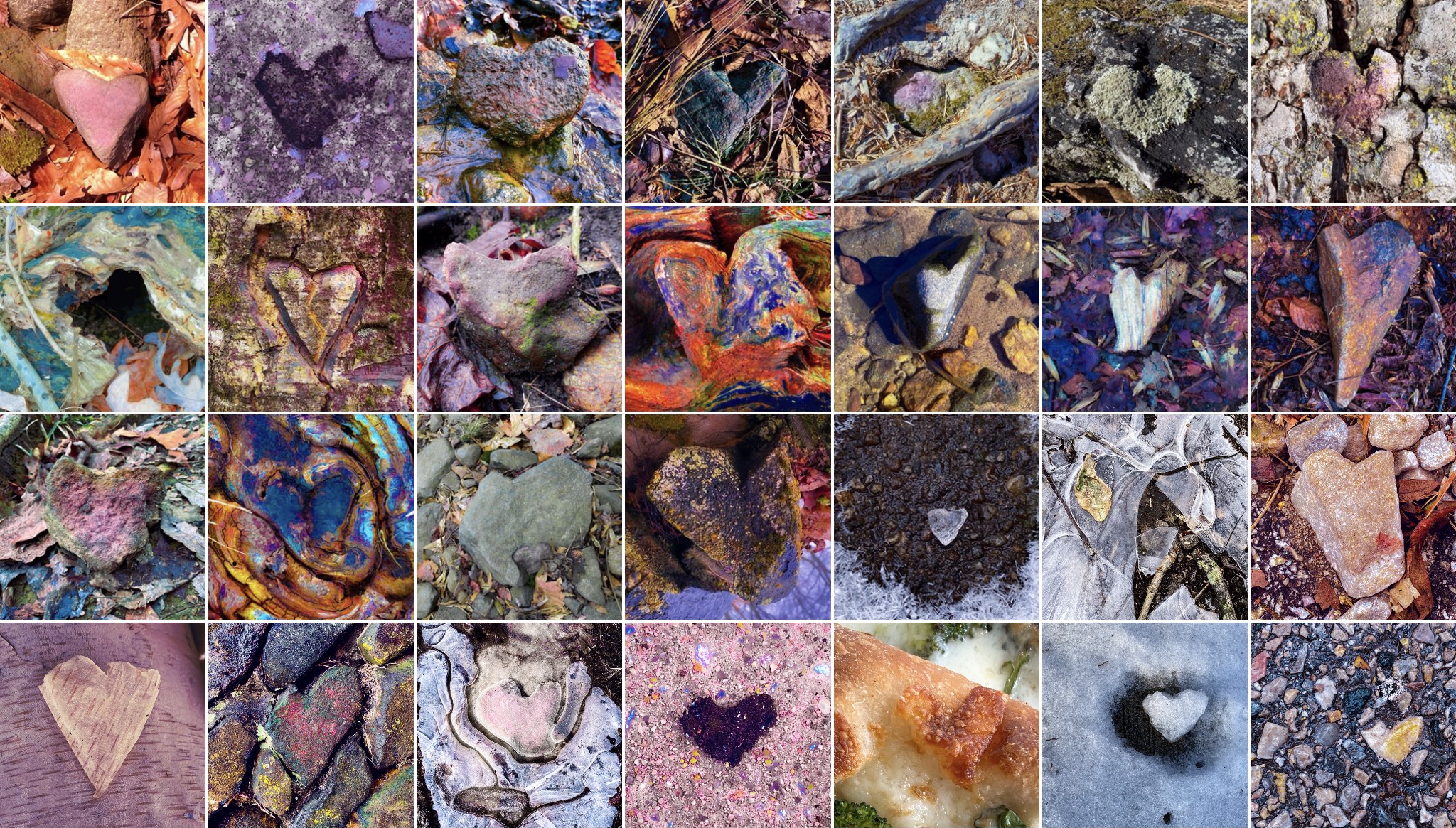
(Intro: I have been very busy with two Kickstarter projects and haven’t been hiking longer than just our daily routine. I am just catching up posting our last two hikes from 2021 😳. I’ll share my heART QR code on the bottom here, and ask you to take a few minutes to check it out, please. Sharing it would be greatly appreciated as well!)
🦮
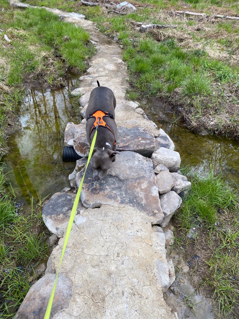
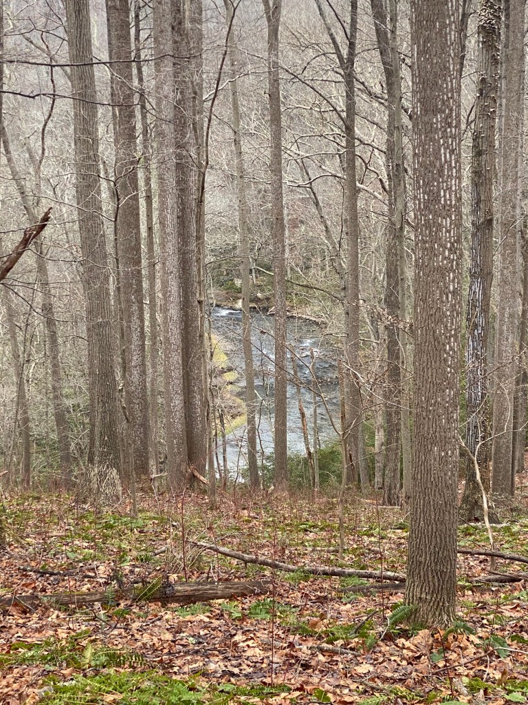
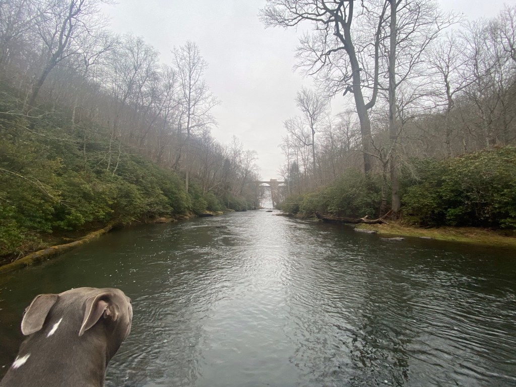
After going back and forth of which trail to hike today I’ve decided on Watkins Glen because of its scenic value. However I wanted to enjoy it without the crowds so we got up early. We’ve arrived at the Upper Entrance at 7:15, beating everyone to it. Parking lot is empty on our arrival. There is an entrance fee of $10/day which is a small token to pay in order to enjoy a marvelous day at this natural beauty.
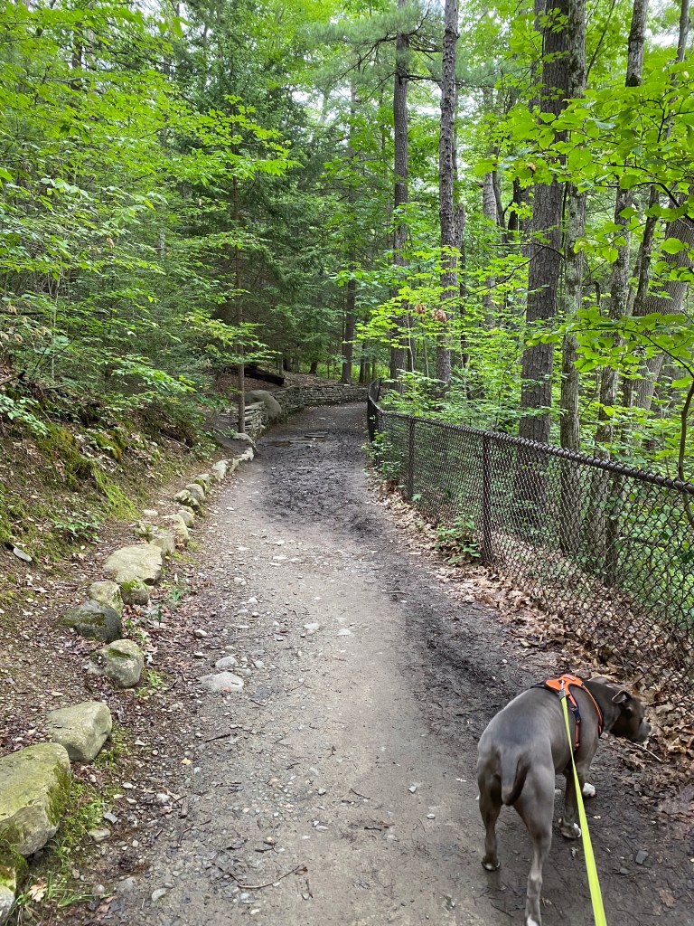
Unfortunately as we proceeded it become clear that dogs are not allowed in the gorge so I had to change our course. There is a parallel (upper) trail so we end up taking a sharp left turn. It’ll take us down to the main entrance and back.
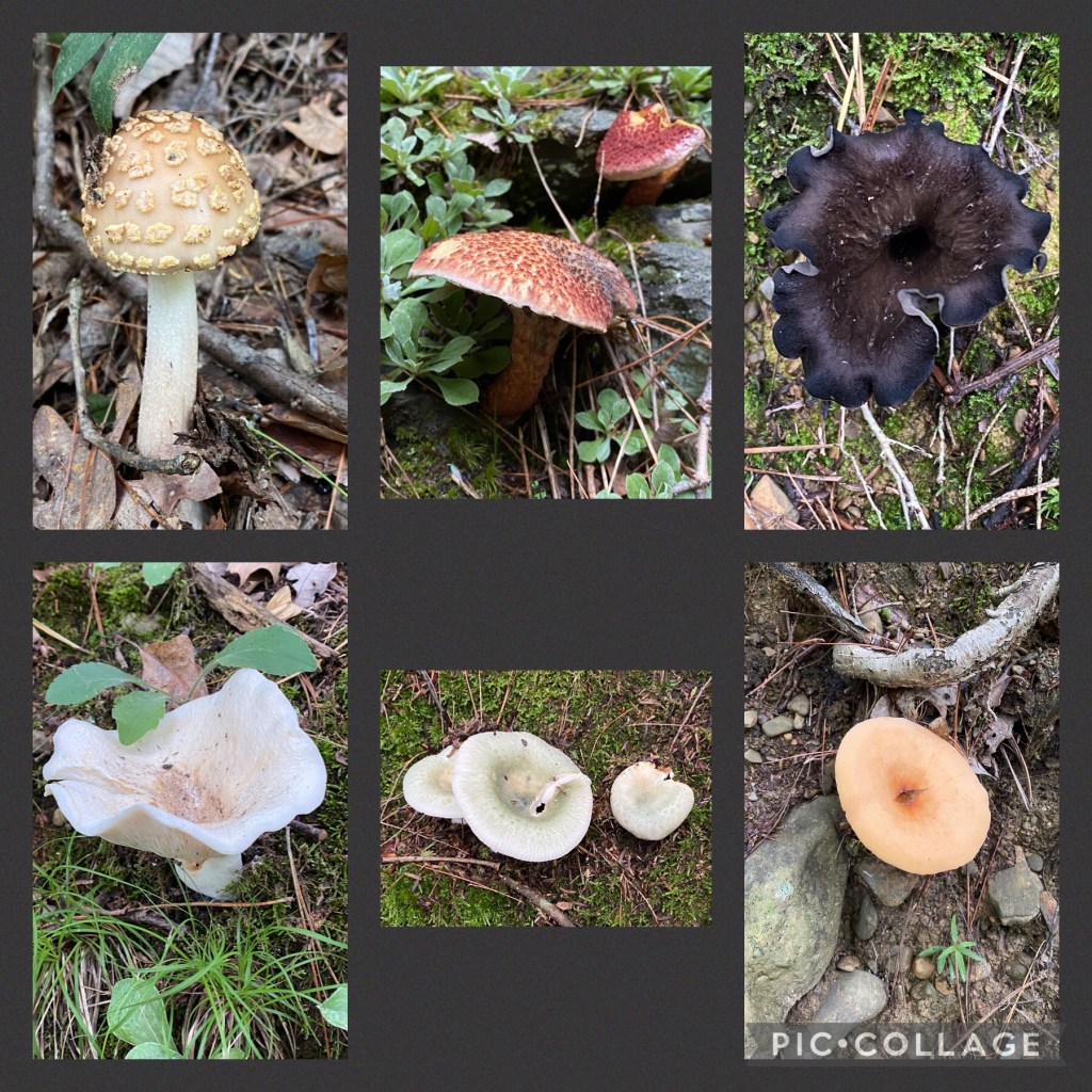
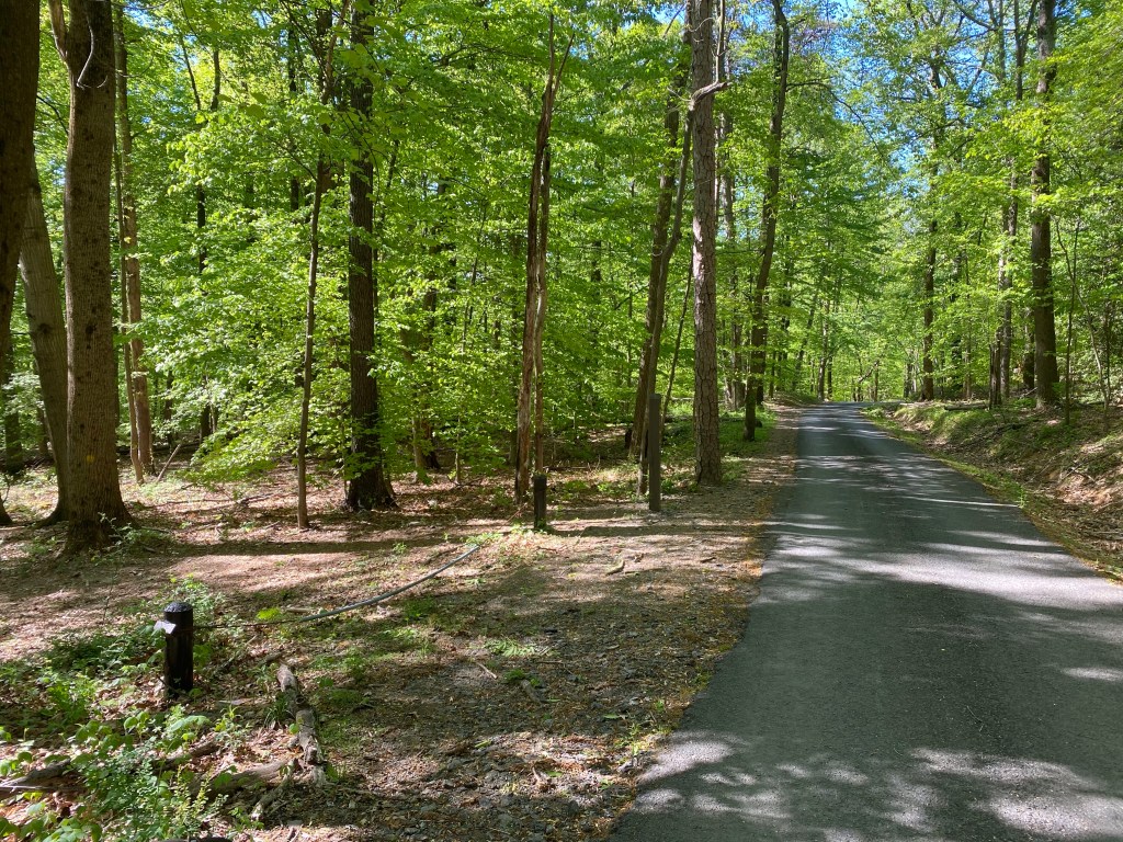
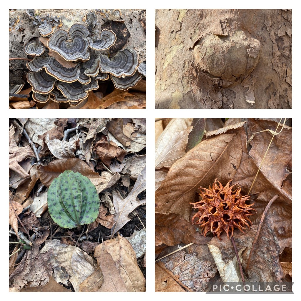
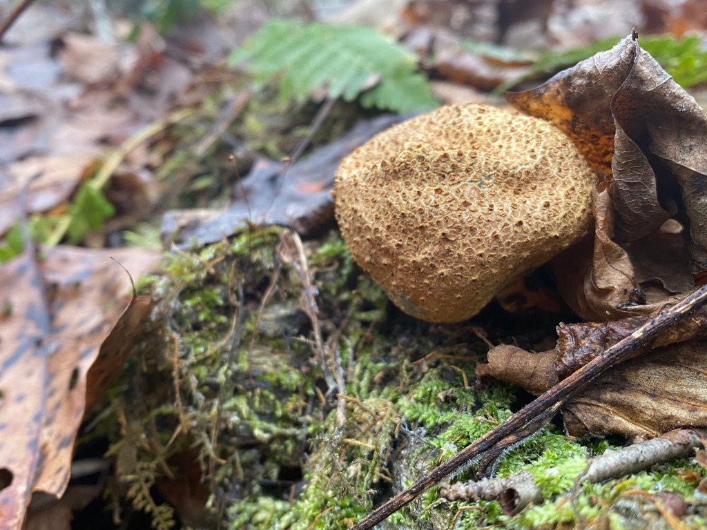
This is still a beautiful, scenic route even though it’s not challenging at all. We are just enjoying nature and new smells – Mag, not me. There are so many different kind of fungi here! Would love to know them all….
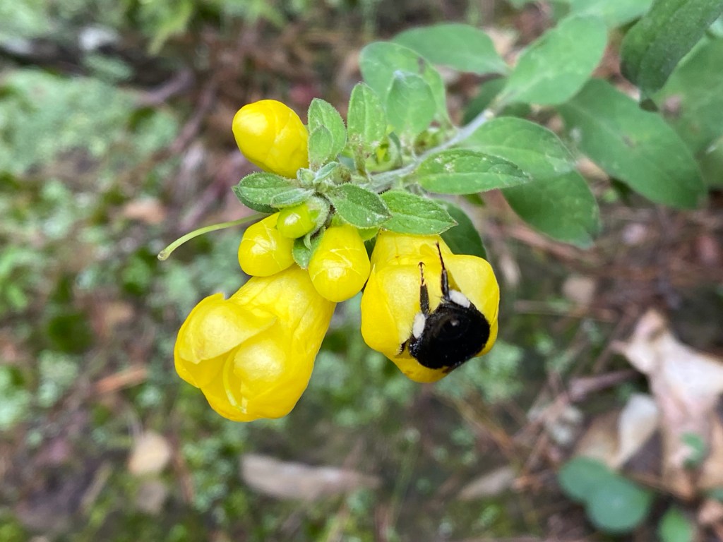
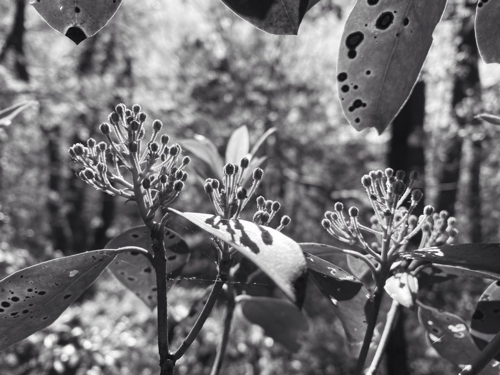
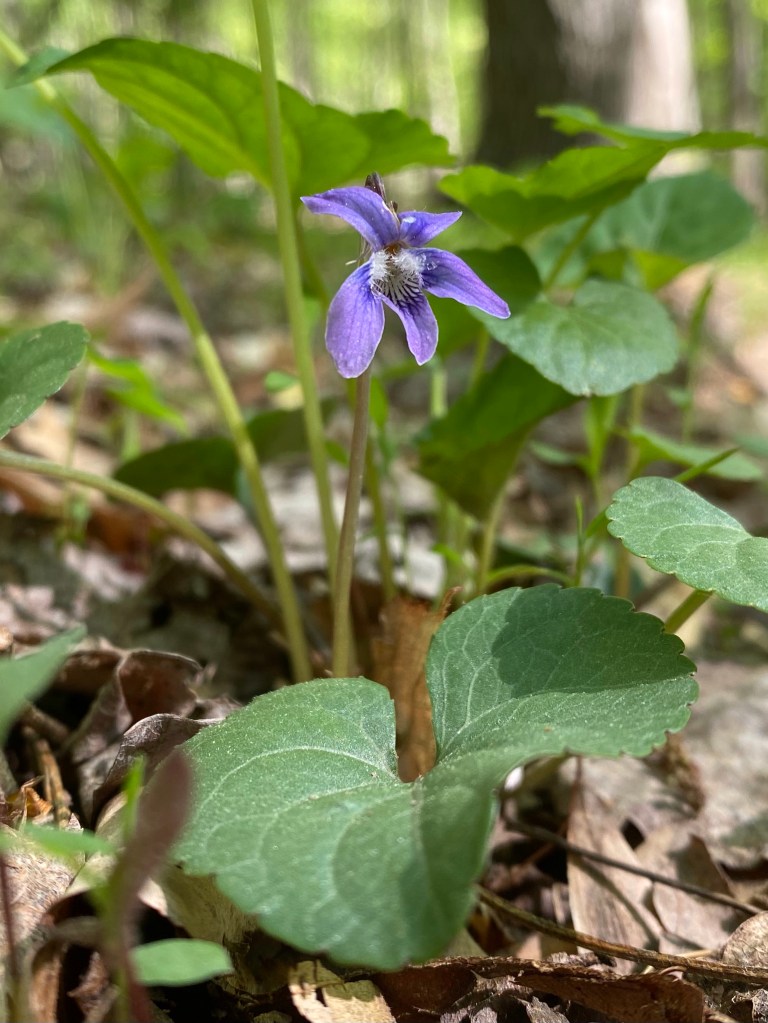
Since it’s super moist around here – hence fungi – there are a lot of teeny-tiny waterfalls seeping through the elevated soil on our left. Lots of different wild flowers are in bloom, visited by all sorts of insects, looking for nectar.
Dasistoma macrophylla and bumble bee
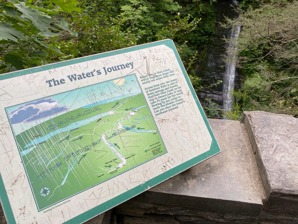
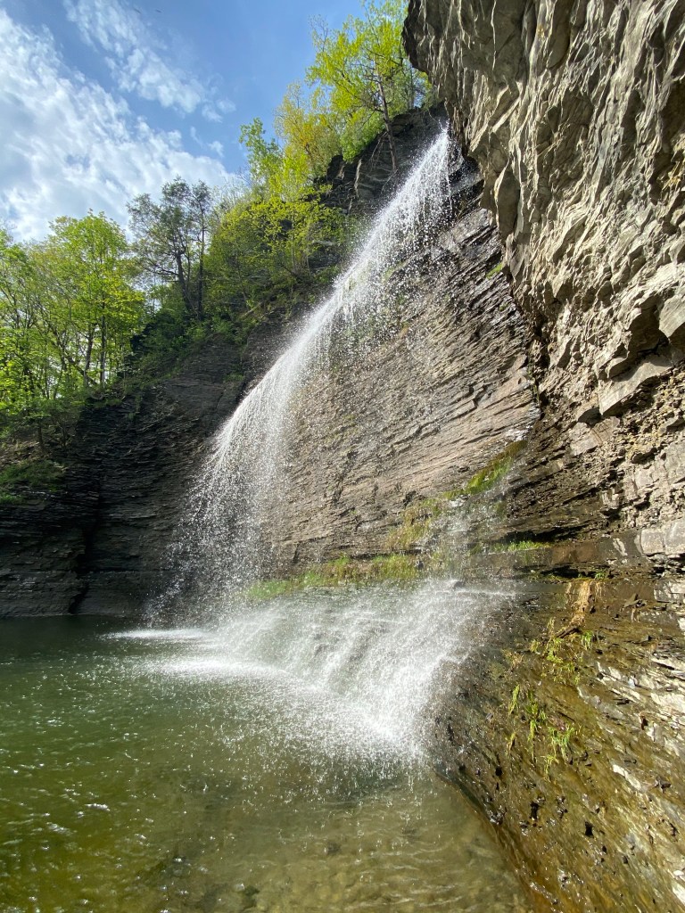
Soon we reach an overlook of the gorge below with an educational board. There are several of these throughout our hike with great information about the water’s journey, “life on the edge”, the suspension bridge and some other topics. This first one comes with a beautiful waterfall view as a backdrop.
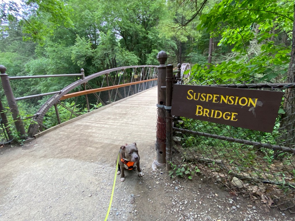
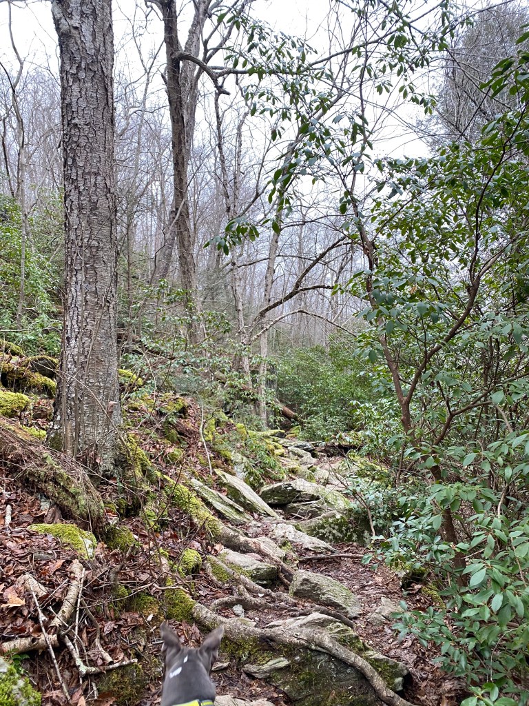
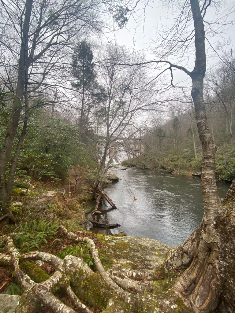
Continue on our journey we pass by more wildflowers, heARTs, a cemetery and some gorg (pun intended) elevated views of the gorge below. Wishing we could be down there, closer to the raging water. After some interesting tree trunks and roots, slow-mo slugs, and the quiet trail to ourselves we arrive to a suspension bridge.
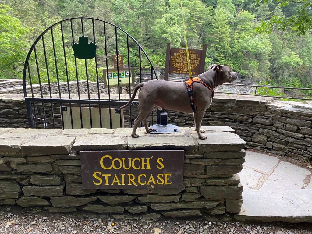
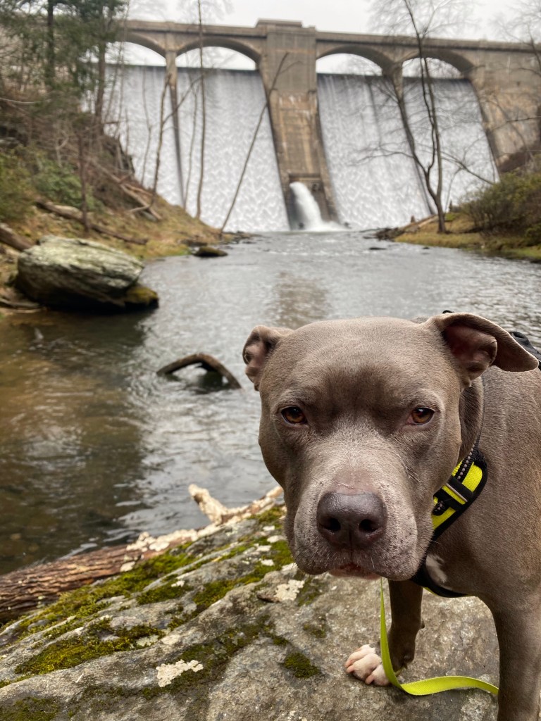
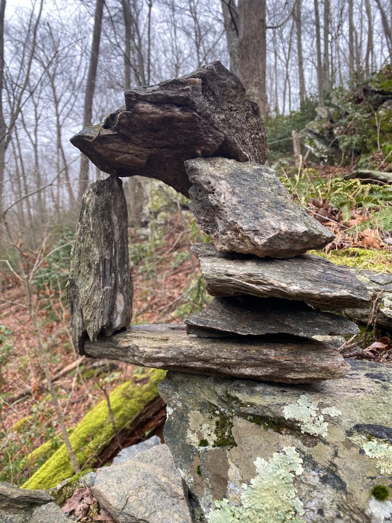
The view below is amazing! Several green terraces along with the gorge’s walking trail and of course the madly rushing Glen. Crossing the bridge leads us to the South Rim Trail. Here we come across several elaborate cairns, hundreds of piled rocks in various sizes and heights. Time and distance goes quick when we are having fun and soon we arrive close to the main entrance at Couch’s Staircase.
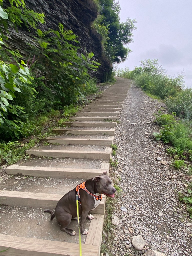
Here we have an other expansive view to the main gate and the widened Glen, along with a peekaboo of the town of Watkins Glen. Take your time to check out all the interesting information at the entrance, lots to learn and shoot some pics as well. We head to the North Rim/Indian Trail to complete our loop. Hope you like stairs….
There are a lot more of them. The view is wonderful looking to both directions. The rumbling Glen is framed by the entrance gate/bridge on one side and the valley down below with the hazy wine hills in the backdrop on the other. Red and deep burgundy Sumac lines the path and I have to be careful to only concentrate to do only one thing at a time. Enjoying the view while photographing and holding Mag can be challenging while spotting heARTs.
Native of N.Y. (B&W)
Our time flies by super quick on the way back and we rapidly return to the car, finishing our hike just under 2 hours. It’s after 9am and the parking lot is full. Cleaning Mag off of the Glen’s muck is a breeze and after having breakfast we head out.I
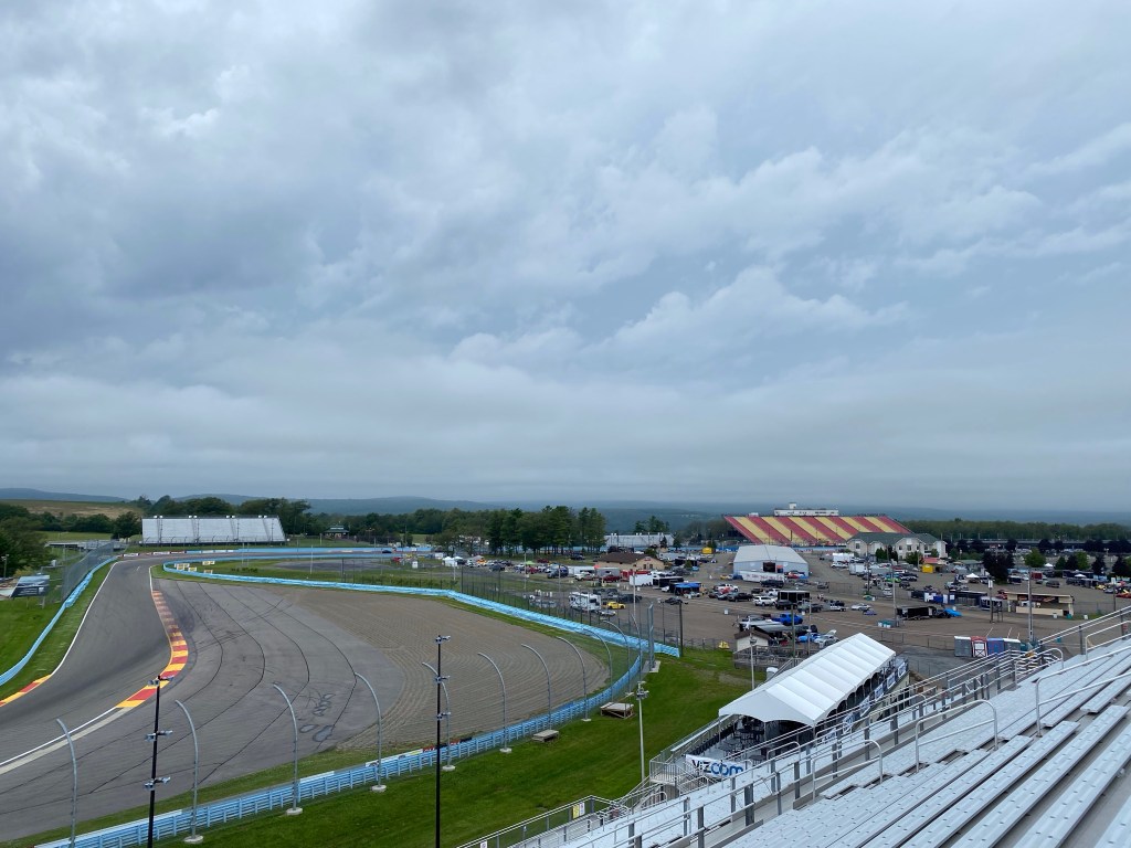
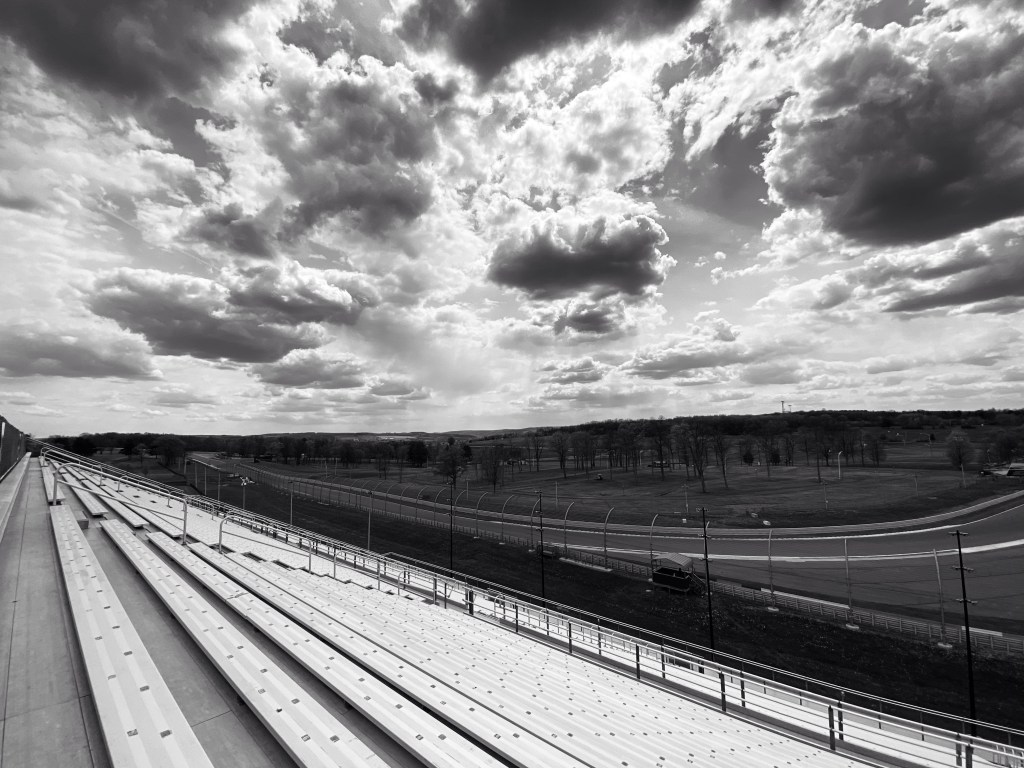
I am planning another hike tomorrow in the Gorge without Mag. Meanwhile we still have to show our faces at the racetrack this afternoon, before the next storm moves in.
Watkins Glen International Raceway
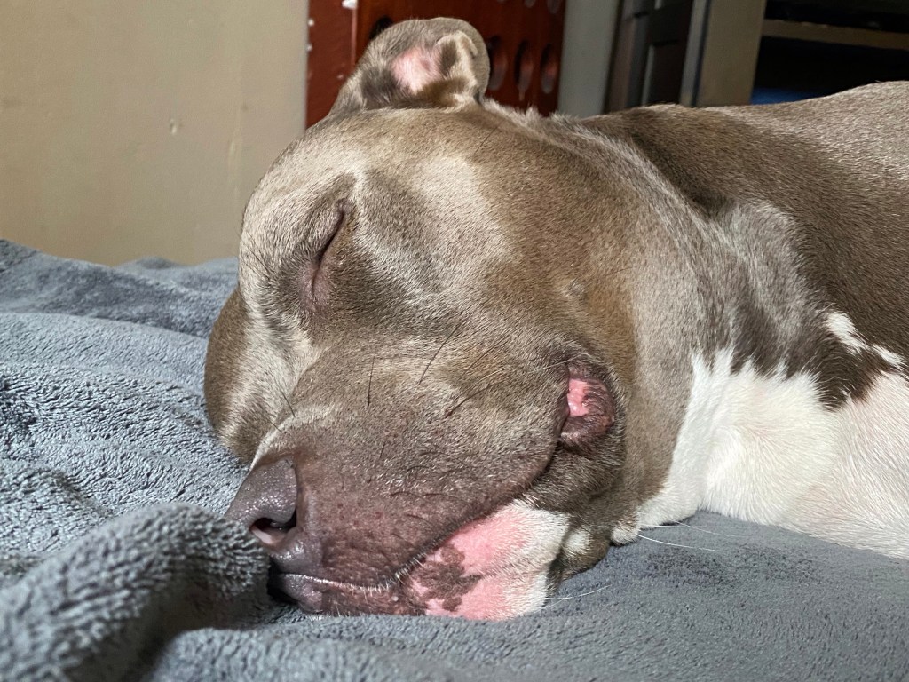
I had to make a run for it from the Jackie Stewart grandstand because it started the pour! What a great day we had! Look who’s is exhausted….
Hope there is another fabulous day tomorrow! Hope to see you here….
P.S.: my Kickstarter QR code for heART as promised. Please check it out and share it if you like my colorful hobby.
Location: Arnot rd. Wellsboro, PA 16901 (Latitude: 41.682667, Longitude: -77.153025)
⛲️
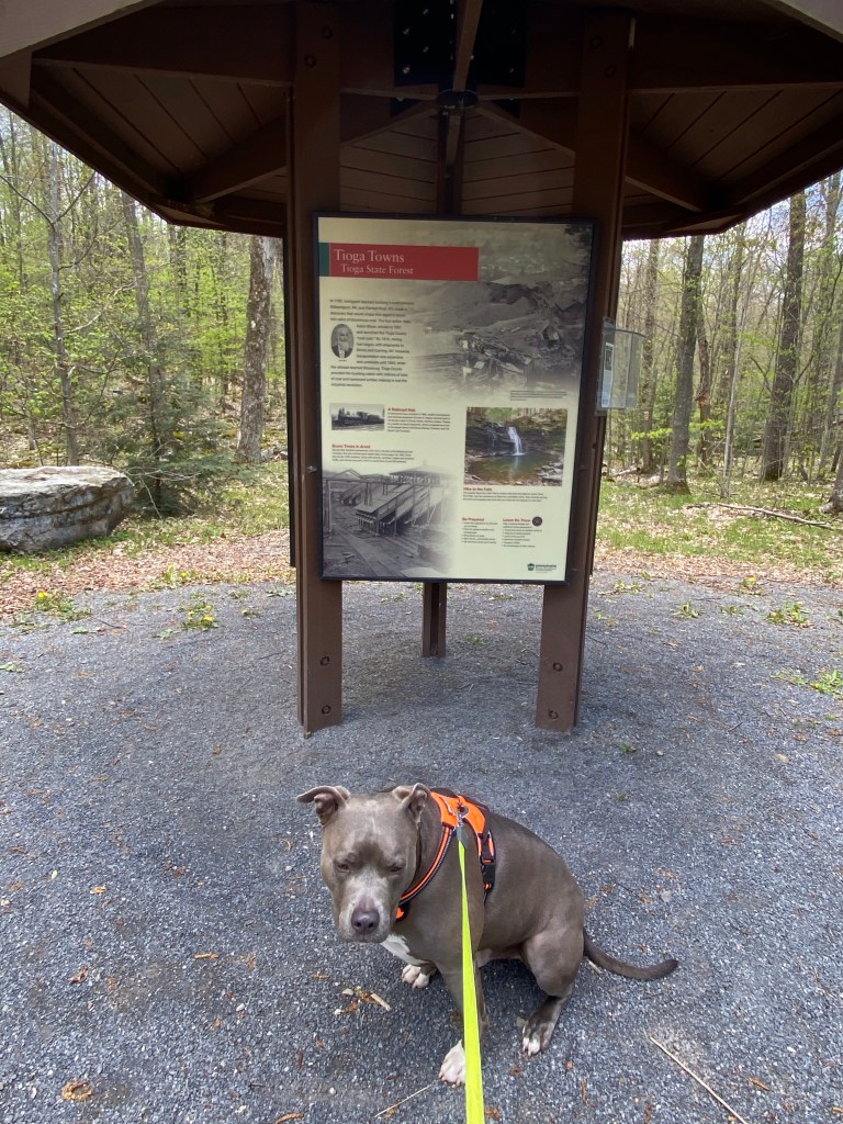
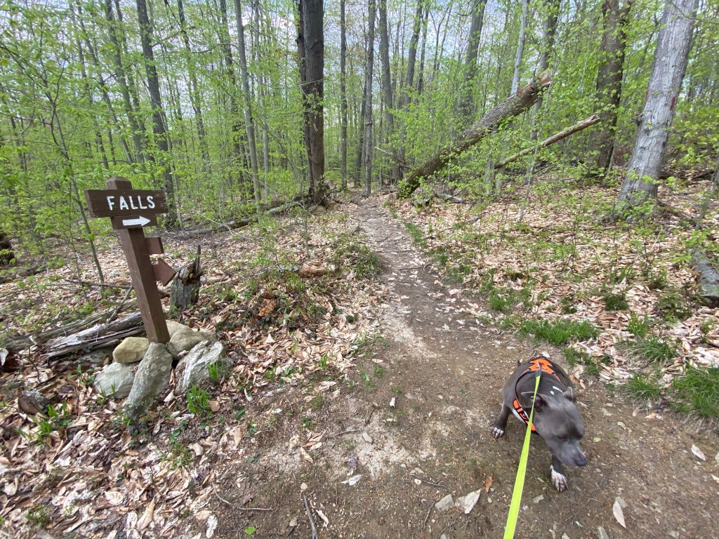
We are driving up to the Finger Lake region in NY for the weekend to hang out with Team Danger on Watkins Glen raceway so I’ve figured might as well enjoy some hiking while in the area. I was looking for trails closer to the interstate and Tioga State Forest stood out.
This particular trail on Arnot rd. is a hidden gem and only about 10 minutes from I15. There are three trailheads and only two cars in the parking area when we pull up. While getting Mag ready one car leaves, giving us a good chance of having this portion of Tioga State Forest to ourselves. Yayyyy!
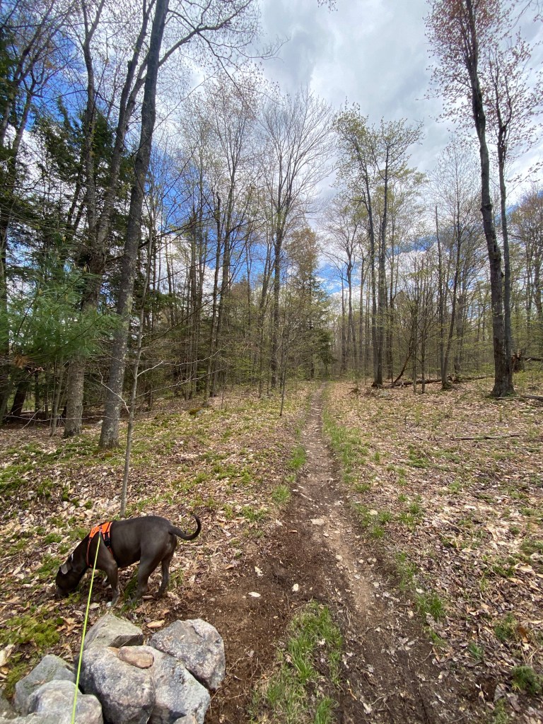
We start out on the left side of the info board towards South. Since there are several splits in the trail from the beginning we lose our ways almost instantly. GPS has a hard time showing us the right direction when we move slowly. I figure we will eventually get back on Sand Run Falls trail so we keep on going. The trail otherwise very well maintained but seems like it mostly busy with bike traffic.
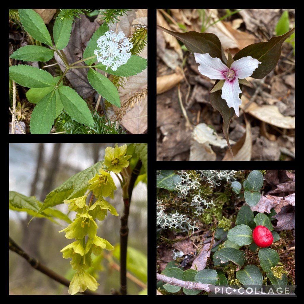
Since the weather got warmer we have been experiencing lots of bugs and mosquitoes. Pesky tiny flies are the biggest nuisance. However, I try to concentrate on the beauty around us and turn my attention to the small white flowers littering the ground. It turns out they are dwarf ginger plants. Who knew? Gorgeous Trilliums pop up all over as well.
Dwarf Ginger, Painted Trillium, ?, Partridgeberry
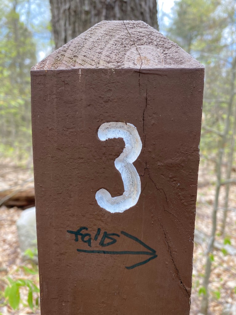
After looping around for about a half a mile, following right turns at every ‘intersection’, we end up at this marker. Someone who knows the confusing maze of trails around here made a sharpie direction towards the falls on stake #3. We are following it….
These stakes are for bikers, I think
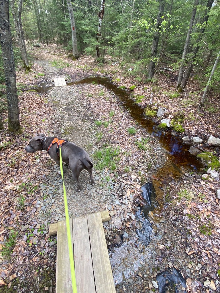
I can definitely see more bike tracks than foot prints here and there are also these tiny bridges over even tinier creeks or more like water runoffs.
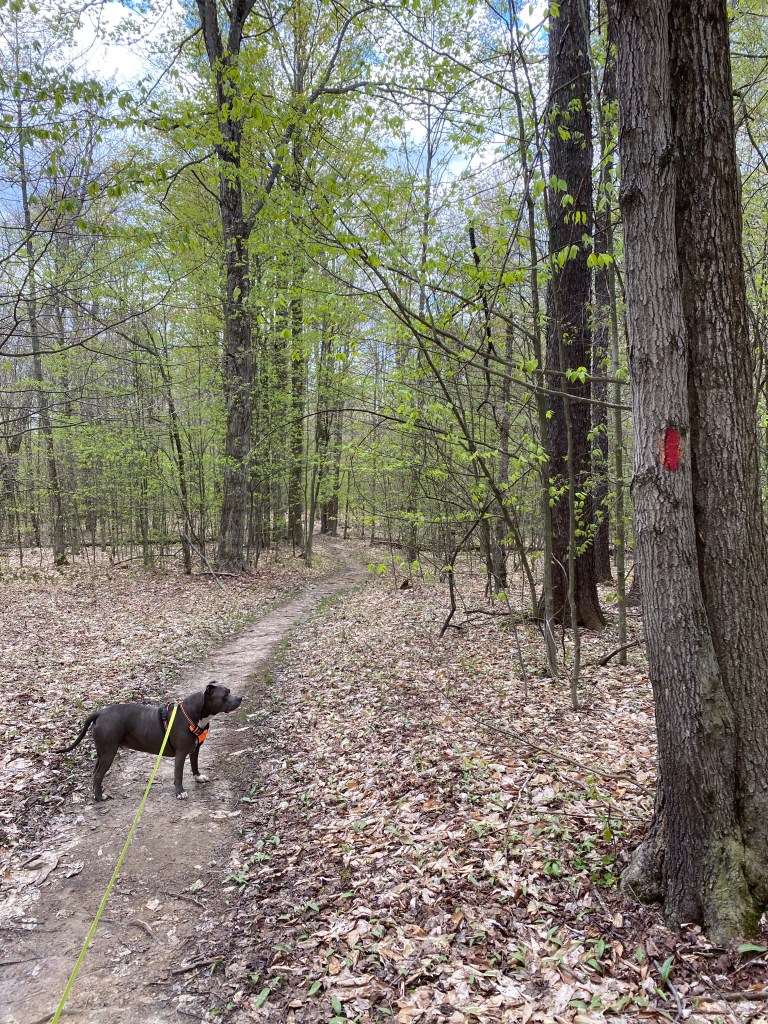
After getting back to our target trail we turn left on it, following the red paint markings, heading towards the falls. At stake #5 and #6 we are keeping to the left.
It is so quiet here! I wish we could have our house in a setting like this. The trail just lazily winds between slim, tall trees, giving Mag plenty of time to sniff every piece of grass there is. Meanwhile, I enjoy the serenity and the only thing that cuts through it ever so often, the laugh of my old friend, the pileated woodpecker.
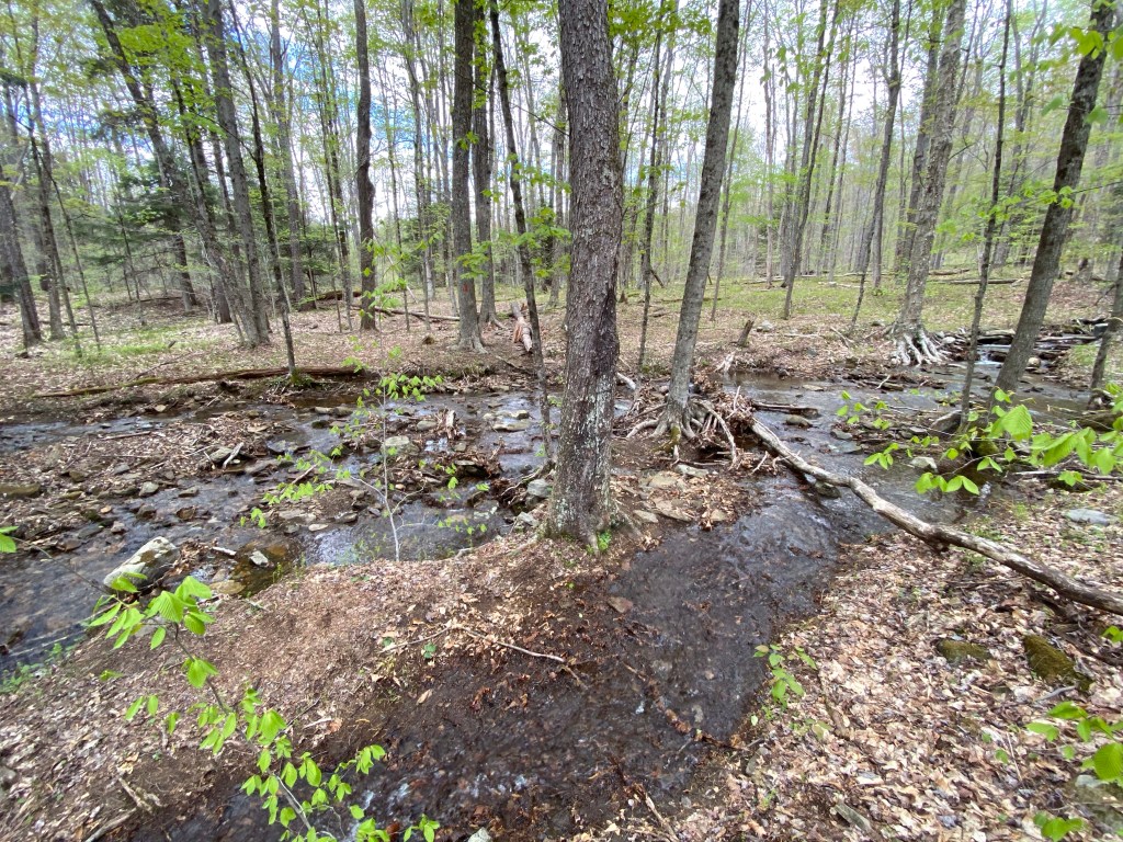
Soon enough we come across a marshy area – after our first descent – hiking parallel to a deer fence. The valley is very muddy and swampy and the now elevated path shortcuts through it. We follow this instead of the original north trail marked on AllTrails. The path is made out of huge rocks and cement, bordered with boggy grass….
…. and huge, overturned roots of once majestic trees. Both colors, red and blue are painted on different surfaces here until we catch up with Sand Run trail on the other side of the mire. At the next marker we turn left again, leaving the fence behind, following the promising sign towards the falls.
Within 0.4 miles we keep to the left again and start a longer but gradual descent hoping that at the end of it we shall see the waterfall.
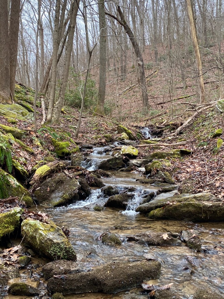
This stretch is about a mile long and as we proceed, water chiming becomes more pronounced. I get a bit excited when we come across a small brook but jumping over it steers us away from the stream. The next half a mile is very pretty, running between a rocky, hilly area on our left and the little creek further down on the right. At mile 3 it’s swells up, taking over a bigger portion of the now lower grade slope.
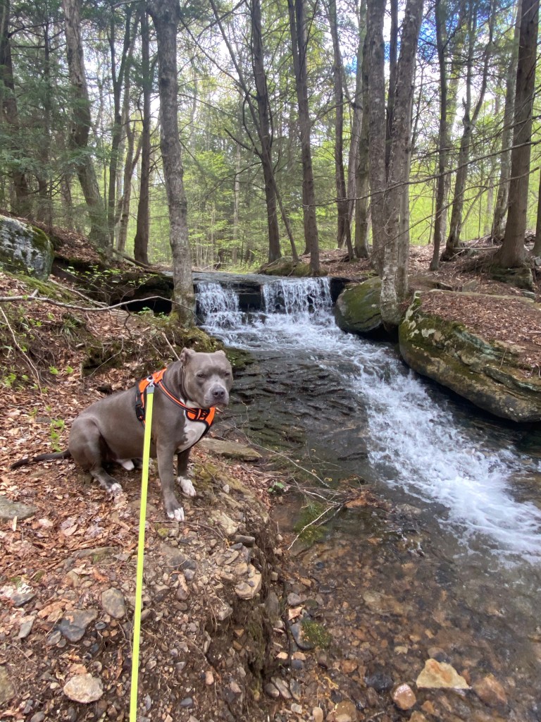
Crossing it again finally takes us to the last signs and low rumbling promises the view of the waterfalls. My first reaction is that it is kind of small but still very pretty. Mag poses for a few shots and after crackling on a branch in the middle of the water we take off.
I am hopeful to see if the trail loops around underneath the falls….
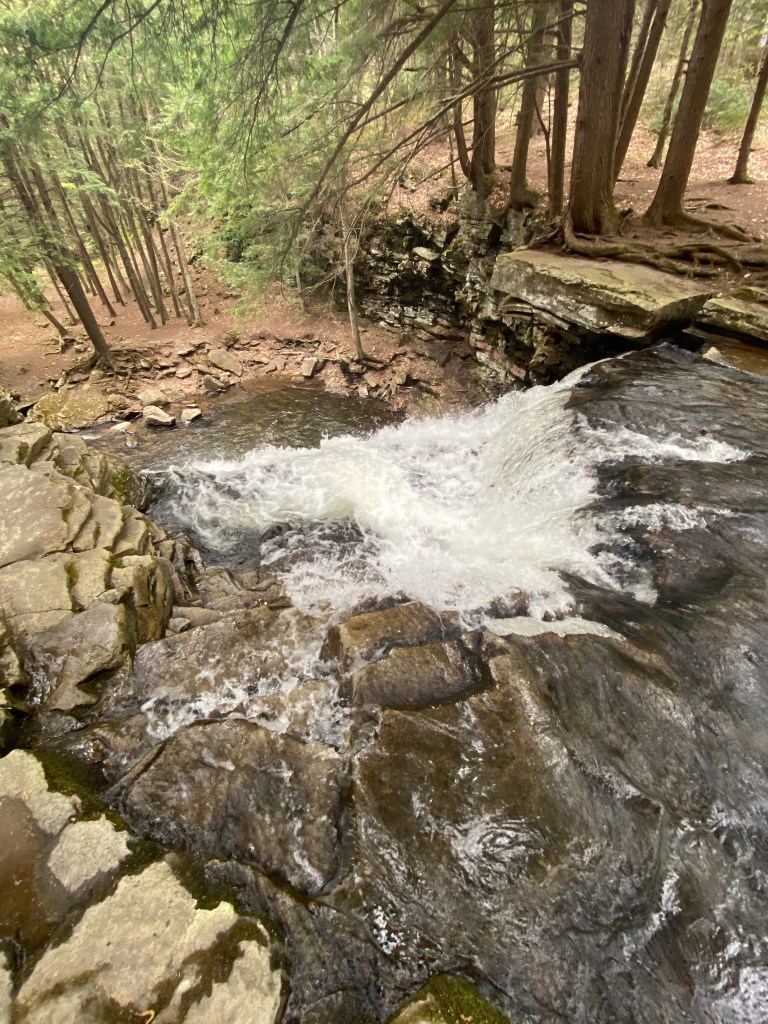
To my surprise the main attraction is just ahead of us and it is absolutely beautiful! We are still above Sand Run but ahead of is the “real” rapid, about 40 ft high. Since it’s partially covered with vegetation as we approach I cannot take a frontal pic. The trail widens than comes up on top of it so we perch on a flat boulder, looking down on the cascade.
Two rivers meet here, Sand Run and Babb Creek to become Pine Creek which flows into West Branch Susquehanna River just above Lock Haven further down south.
I would love to make it across to see it from another angle but we are running out of time.
If we want to make it back to the car and then to the track by 5:30 we have to leave immediately. It’s half past three so we have two hours to get out of here and drive up to Watkins Glen. We wave farewell to the wonders of Sand Run while I am already making plans in my head to return here.
Backtracking a bit will take us to the last markers we’ve encountered, where we keep left now, towards the unknown. It gets very muddy for several hundred feet than clears out. All runoffs are heading to the river, making this portion swampy. We are on the orange – a.k.a. Mid State trail by the way.
This approximately 3.5 mile portion is almost a straight shot back to our car but on the map it looks more like a curve of a bow. I am pushing a little bit harder than usual because of our time restriction but at one point I have to admit we will not make it. We’ll have another opportunity to walk Watkins Glen raceway with our crew.
Half way back we encounter our first set of humans, four ladies headed to the falls in a comfortable pace. They must be locals….
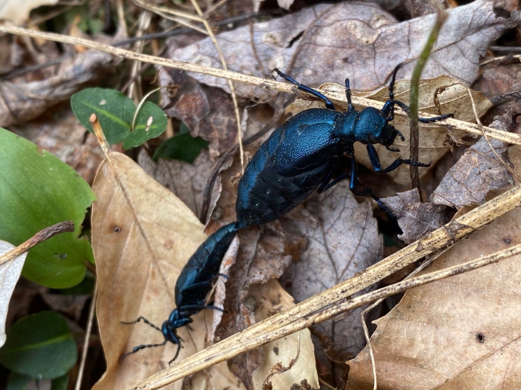
In about 10 more minutes another person emerges from the woods towards us and after a short step aside we leave him behind too. It is so quite here that I hear every little rustling in the groundcover. This time the sound comes from a pair of mating blister beetles (Meloe violaceus) or commonly called oil beetles. They release oily droplets of hemolymph from their joints when disturbed.
The other sound that catches my attention is coming from nearby Sand Run but the water stays mostly invisible behind the tree-line. Seldom peaks through, running parallel to the trail, even beyond our target location of the parking area. Before we reach it, our path becomes sort of a divider in the middle of a hill. River down below, hill up above on our right. Getting closer to Arnot rd. becomes obvious when I start hearing passing by vehicles on the paved surface. This map at the trailhead marks the end of our journey.
We parked a few hundred feet in on the off-road driveway and the view of our car is a welcomed sight for both of us. Mag jumps up right away and plops down. He knows it’s time to check for bugs. Ticks in particular. I carry a small jar with water to dispose of them if found. I don’t like the idea of releasing them back in the woods.
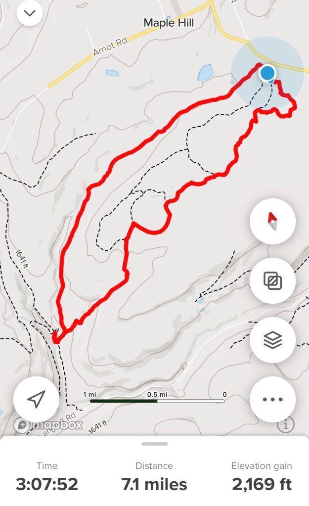
Here is our trail map:
Since we are not now in a hurry to get to our destination, I drive in a comfortable pace. Our rented bungalow for the weekend is awesome and as it turns out it is close to several waterfalls.
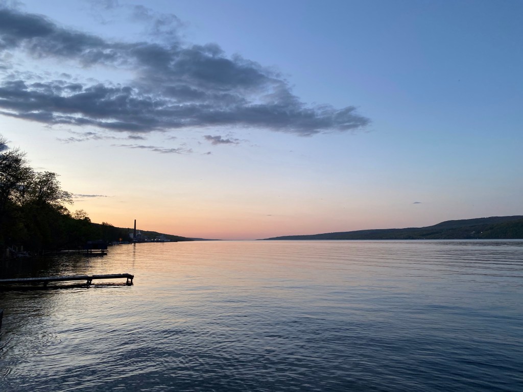
For dinner we head over to our friend’s rented house located on beautiful Seneca Lake. The sunset is not too shabby from here.
Even though I had plans for another hike on Saturday and the trail I’ve found is dreamy, our hike was cut short. Mag suffered a minor injury 2 weeks ago while doing our routine evening walk and yesterday’s trip opened up the wound. We were able to do 1 mile in but his limping was so pronounced I’ve decided to turn back.
We ended up on the racetrack, hanging out with the guys but sitting still is not my thing. ‘The Glen’ is sitting on 550 acres so we take a slow stroll. I climb up on one of the huge grandstands to take some pics while Mag enjoys the AC in the car.
Well deserved sleeping in on our last day is a given….
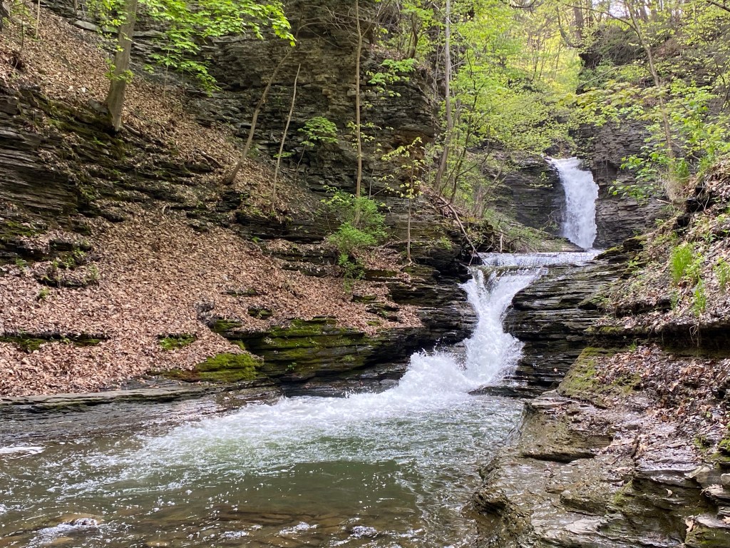
Before we hit the road we must chase those famous waterfalls this region is famous for. Unfortunately Watkins Glen State Park is closed at Rainbow Falls for the season – opens May 31. But there are other gorgeous cascades within reach.
Across from our bungalow is this beauty:
Deckertown Creek Falls
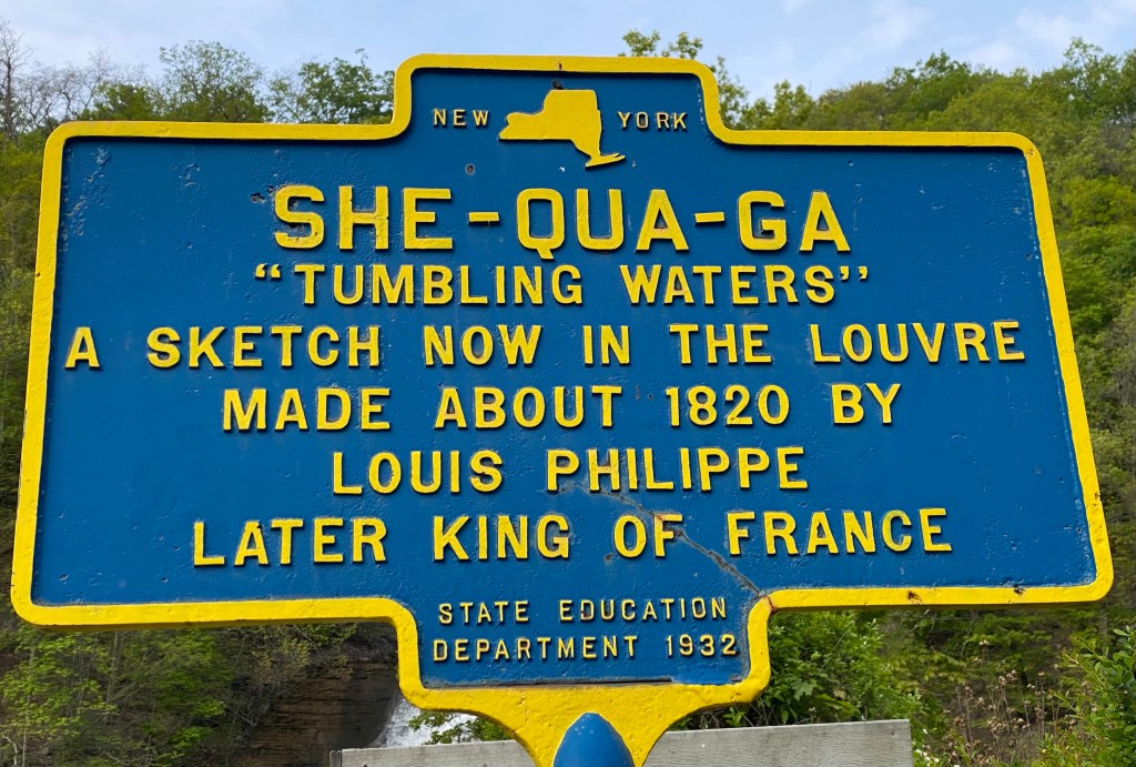
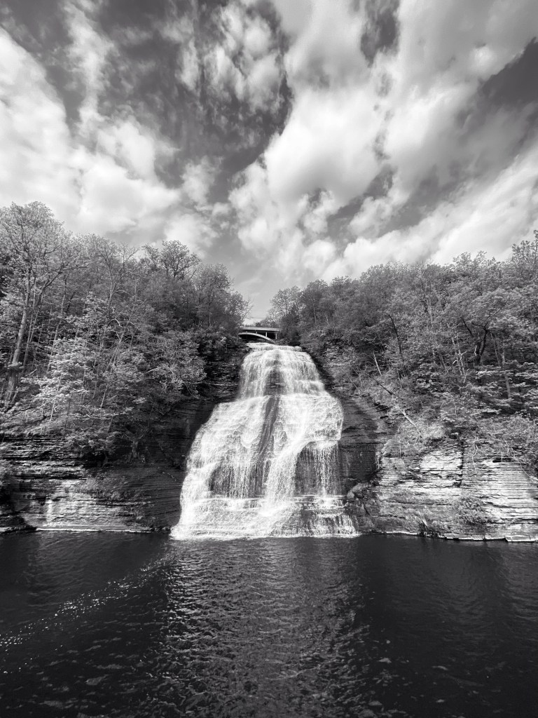
Montour Falls historic district hides this gem:
And while heading out of town Montour Falls or Aunt Sarah’s Falls waves us goodbye.
Montour Falls
Such an amazingly beautiful area this is and so much more to discover! We’ll be back in July to continue. Hope you’ll be back to read about it.
But I mostly hope to see you out there, discovering for yourself. But remember!
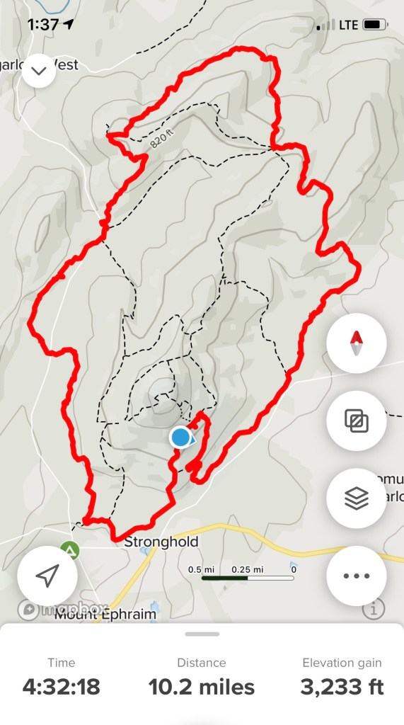
Originally I’ve planned to hike around Harpers Ferry but parking is inconvenient so I’ve decided Friday evening to change our plans. I wanted to see my hubby and the gang at Summit Point Racetrack after our hike. It didn’t seem too far to hop back in the car and drive out. Plans can change tho….
It took us an hour and change to get to Sugarloaf with lovely scenery from I70. Make sure you have at least $5 on you before entering the property, visitors encouraged to contribute to the nonprofit corporation which owns the land. Stronghold Inc. was organized in 1946 by Gordon Strong. He and his wife purposefully gained ownership of the many tracts making up the present property prior to their death. Sugarloaf has been designated a Registered Natural Landmark supported by a modest trust fund, membership dues and gifts from visitors after entering the gate. I took a very helpful map of the trails and a welcome template as well.
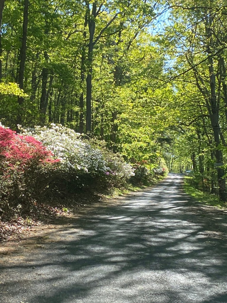
The drive to the spacious (175 spaces) East parking area is about a mile, through a one way serpentine road. Drive slow, there are several trail crossings and hairpin turns.
Azaleas leading the way
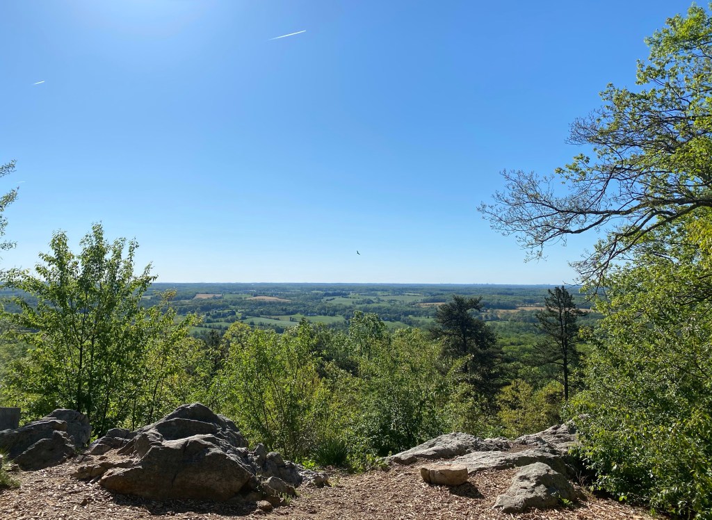
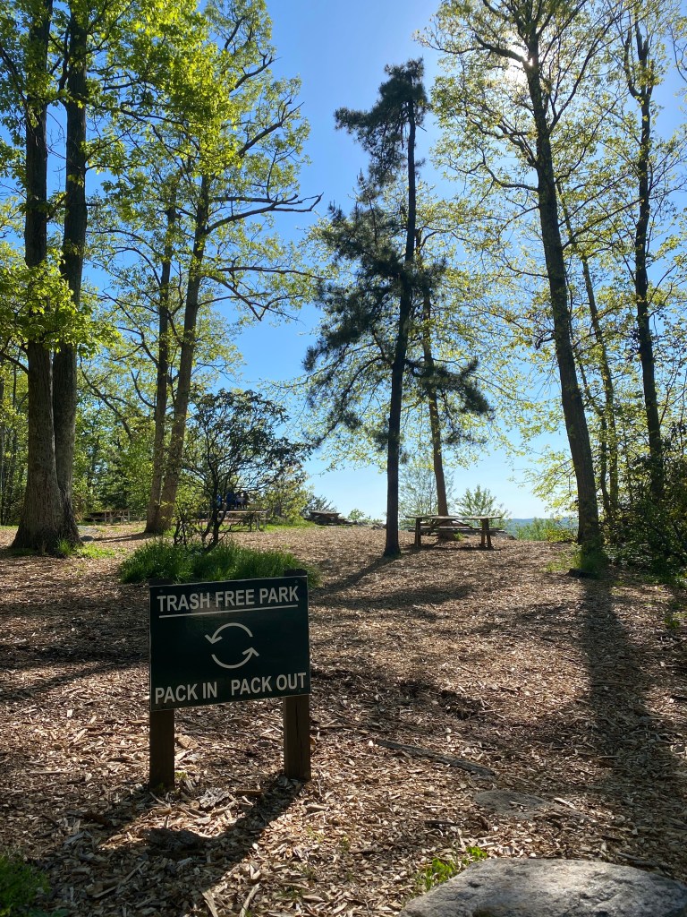
Get here early enough to beat the crowds and in the summer months, and the even more annoying flies. Starting out from the East view parking I made sure to take at least a few shots of lovely Monocacy Valley below. The mountain’s highest point is at 1282 ft.
Buzzard in the middle
We quickly hop on the white trail or Mountain Loop and take the first right towards South just after about a hundred feet to hike the longest route. While approaching our turn I eavesdrop on two girls behind us mentioning Budapest and get into a small conversation with them. Turns out one of them also have a page and I make a mental note to check it out. Hikers/bloggers unite!
At the turn
The surroundings are already reminding me of Catoctin Mountain (blog post 4/25/2020). Steep downhill, with lots of rocks and roots bordered with the now almost bare Mountain Laurel bushes, just before flowering.
Where the white trail crosses Sugarloaf Mountain rd. we continue down (left) on the paved surface through the hairpin turn. The yellow trail starts from out of nowhere and we have to proceed this way to get to it. Since it’s after 9 am, cars are more frequent and I am sure filling all 3 parking areas quickly.
Yellow trailhead
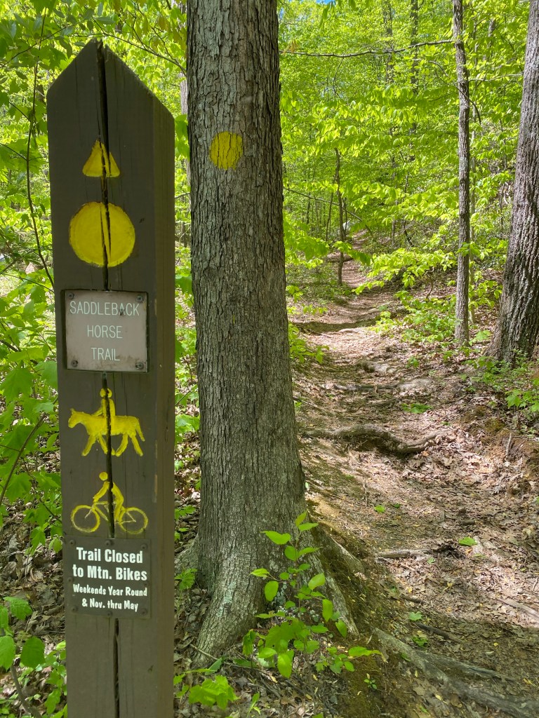
Saddleback Horse trail or yellow trail is a very spacious beautifully shaded path starting out parallel to Sugarloaf Mountain rd. There are lots of hidden treasures on the ground so don’t just get mesmerized by the beauty of tall trees.
We don’t encounter any but these woods are also home to the timber rattlesnake and the copperhead as well. Look but do not touch!
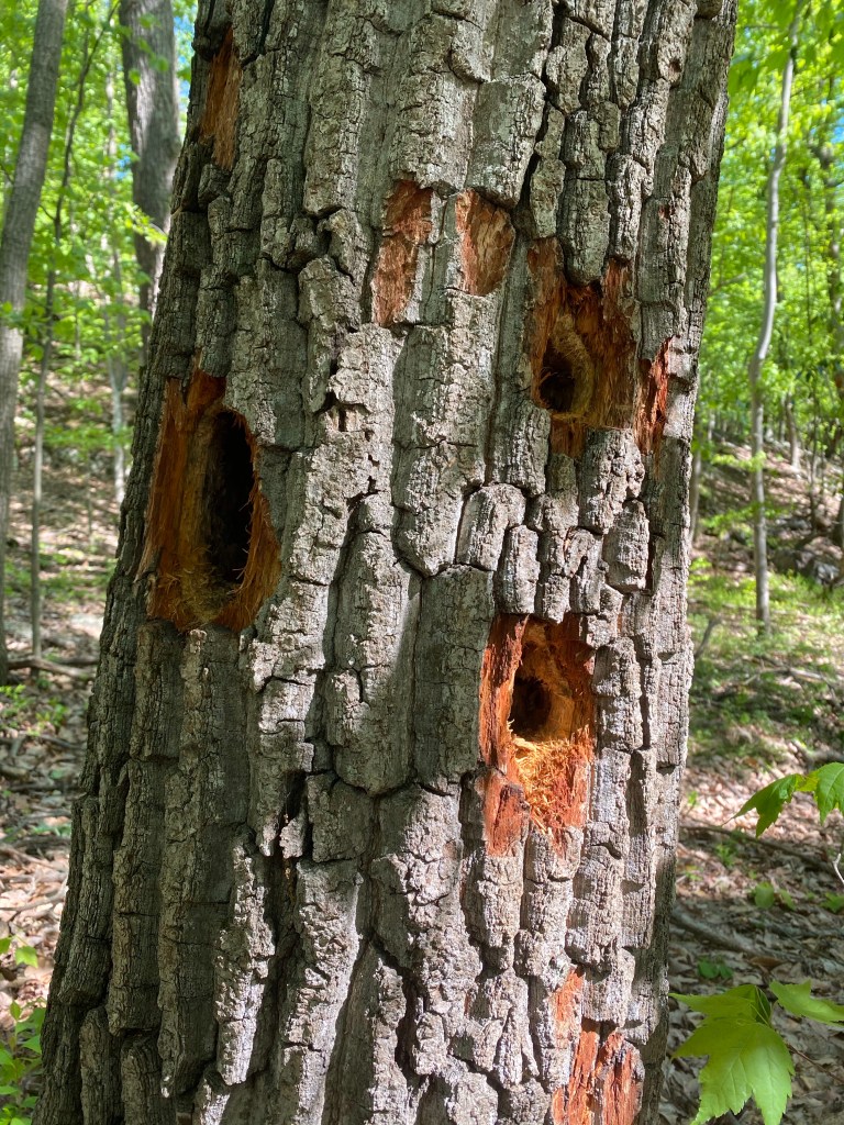
A Pileated woodpecker however is easy to be heard from a mile and even tho they’re harder to spot, their “handy work “ is all around us.
One of these mohawked, magnificent birds is teasing me yet again with his loud “laugh” on our right then flies across in front of us and lands on the other side of a tree, staying out of my sight.
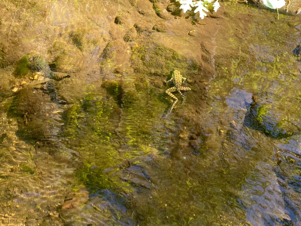
Further up the road we have to stump through a few muddy patches and a small brook. It is lazily moving along to join other small streams in the area to get to Little Bennett creek. I almost step on a gorgeous green frog and make him cancel his sunbathing session, splashing into the water.
Springy froggy
We encounter the first fellow hiker at around mile 3 with her miniature schnauzer. It’s easy for her to pick up the small dog before he starts yapping. I need chicken to distract Mag before he shows his Dr. Jekyll side.
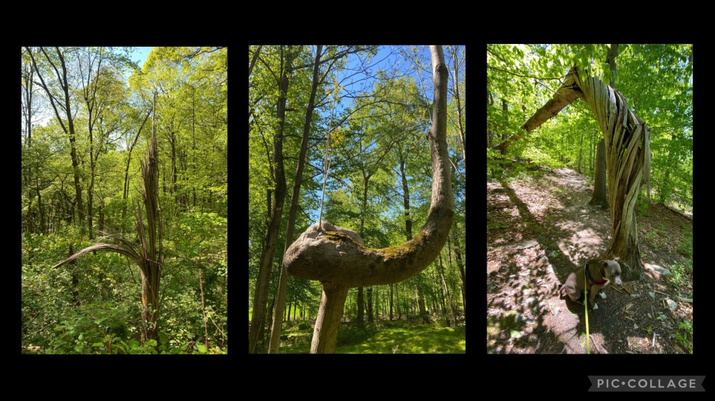
Through our hike we come across several funky looking trees….
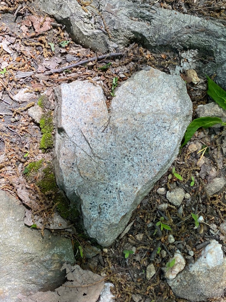
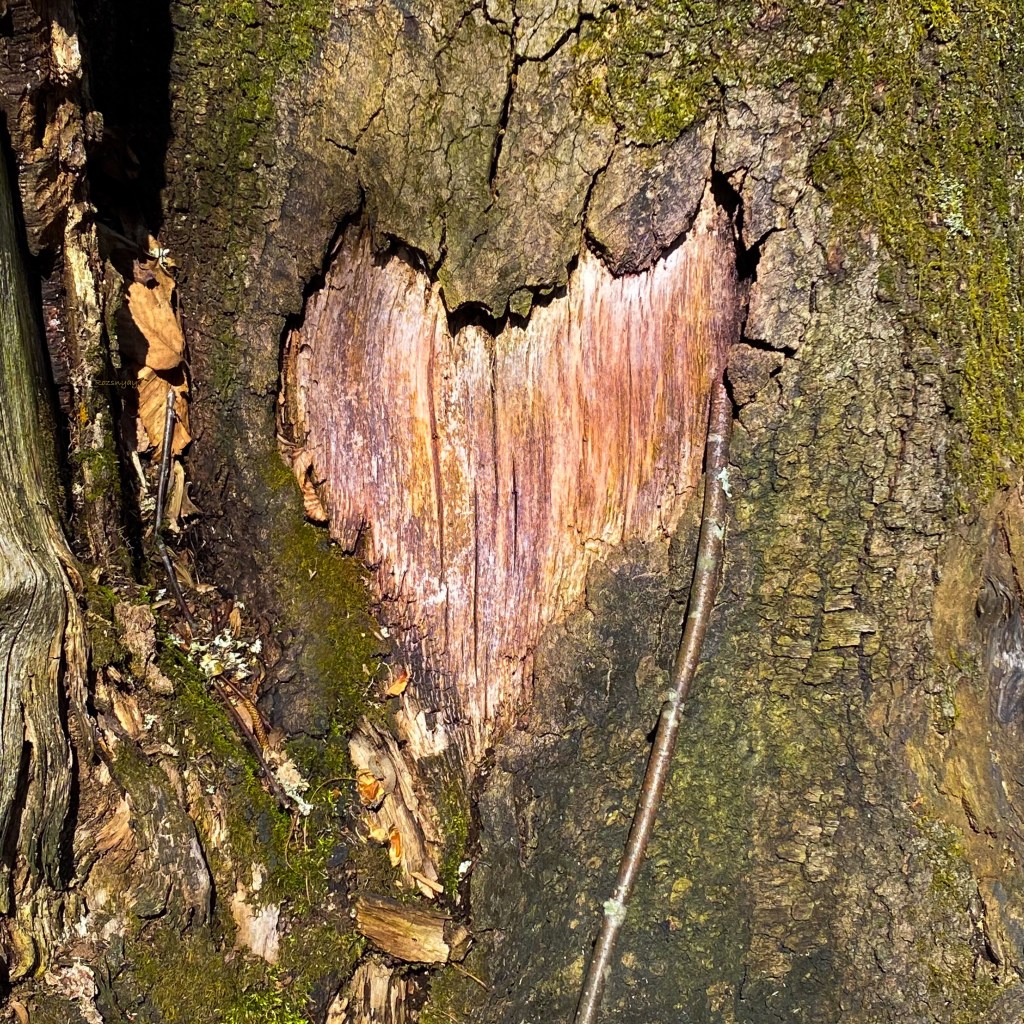
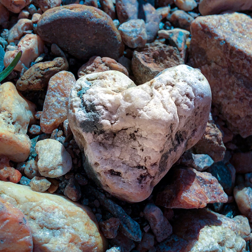
…and pretty little hearts for my ongoing art project, heART by Eva.
That’s a nice one!
We are at about elevation 500 ft at the lowest and after climbing the hill we are at about 820 ft. Even flying creatures take a brake after an ascend like this.
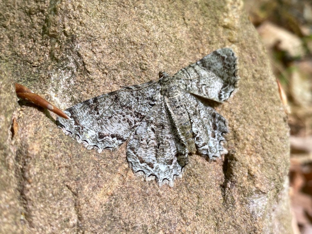
Common gray moth?
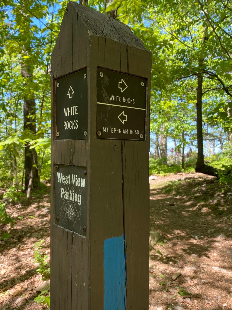
While another woodpecker hammering a tree close by we walk out to an open area. A Red Shouldered Hawk takes off from a low stump and disappears into the woods. On the other side of the clearing modest downhill starts, leading us to a five trail intersection. Slackers (😉) cutting through Northern Peaks trail to White Rocks towards the west meanwhile we leave the crowds behind, following the Purple trail.
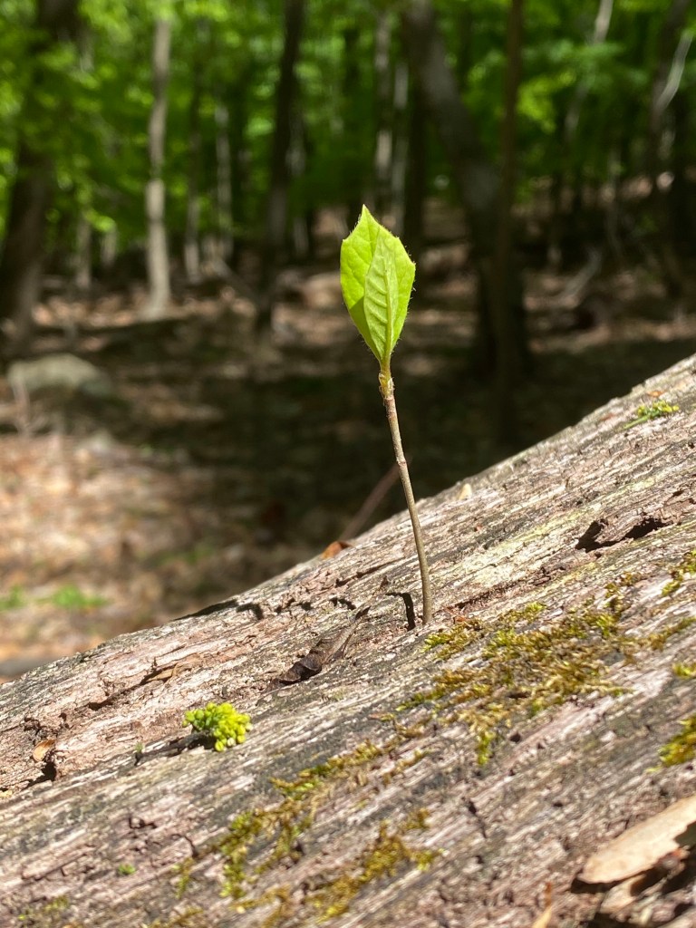
new life
This 1.6 mile detour to White Rocks is relaxing and serene until a huge boom sounds somewhere. I don’t know if there’s a quarry nearby or a shooting range. It startles both of us a bit until my attention turns towards shooing away many annoying horseflies. Trying to speed them off propels us to the overlook in record time but we don’t make it out to see the view. I don’t count but about 30 people are already on the rocks. I pass on the opportunity to see the panorama and we quickly proceed to the blue trail.
Encounters with other fellow hikers are more frequent from here to Mt. Ephraim rd. (6.8 miles into the loop) where taking a short break at Bear branch is a must to refuel Mag.
Following the paved road for a few hundred feet until the trail divides into blue and yellow. We keep marching on the yellow to our right. I have removed my hoodie long ago but I am glad I was wearing another long sleeved shirt underneath. We hit another swarm of small, biting flies.
After crossing Mt. Ephraim rd. once more we come across a sign for a Stewardship Demonstration Forest. Within this pretty big area are several other markings providing visitors with a visual representation of common forest harvest practices.
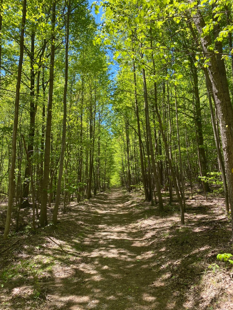
The alley of trees on this long stretch is just wonderful.
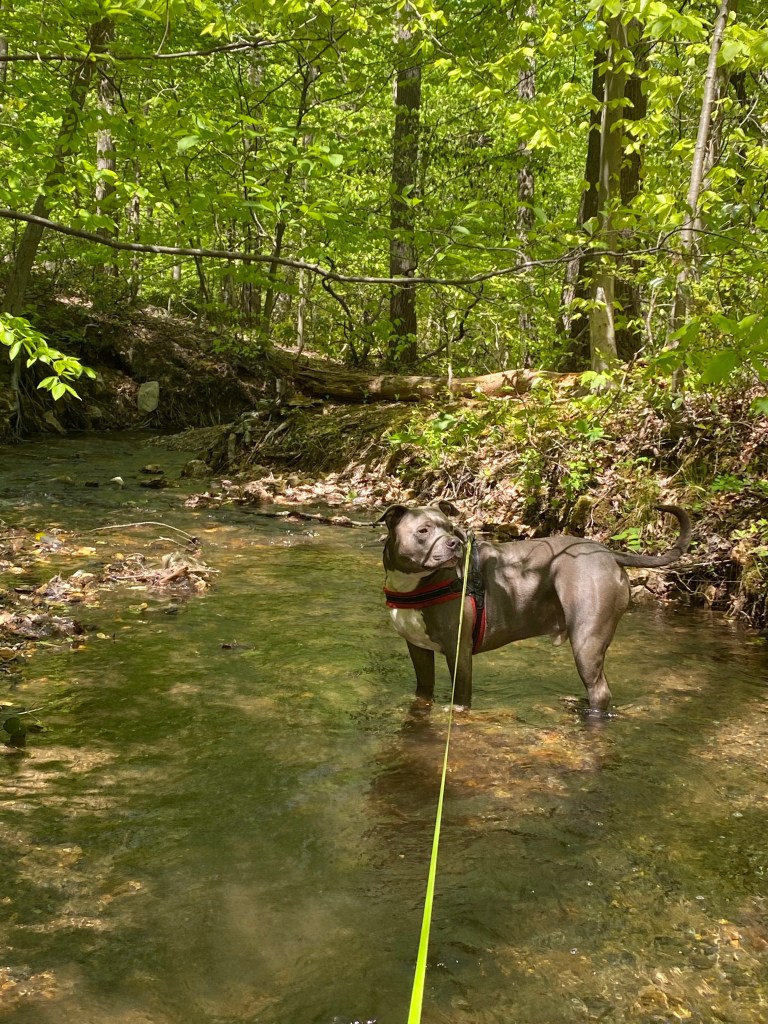
Coming across another pitstop at Furnace branch to Mag’s delight. Drinking and splashing in streams are his favorite things when hiking. After the brook, the path becomes wilder with rocks and boulders. We get another destruction in the form of a chopper, it sounds like it’ll land on top of our heads. Trying to look on my flight radar app to see what’s going on but no avail.
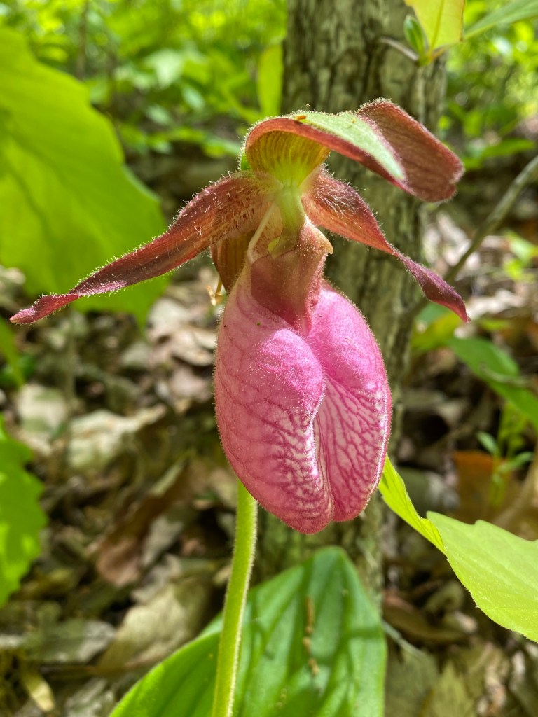
We have been also chasing a couple with a dog. They been slowing us down. Thankfully just in time I notice this Pink Lady Slipper. My day is absolutely made!
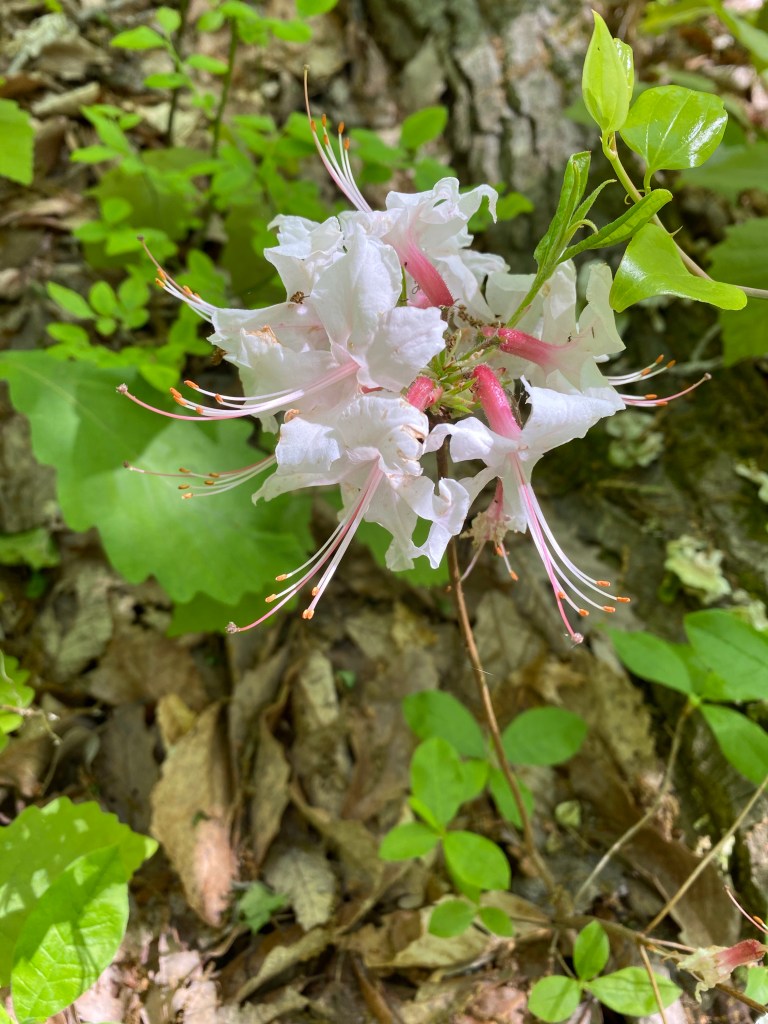
Right next to the slipper was two skinny stems with these flowers. It seems like some sort of azalea….
Dwarf Azalea?
After my delightful discovery and a sudden left turn we merge with Mountain Loop trail. The bottom of it runs parallel to the main, one way road exiting the property. Close by is the private Strong Mansion and Westwood Mansion. While passing a small picnic area and the entrance building, Mag takes several rolls in the cool grass.
I make him hurry up a bit since there are people behind us. We quickly get back on the last portion of the white trail even tho there is always time for a photo.
On the last small section we follow an unofficial portion to cut through to the parking area. It is a bit steeper but drops us off almost at our car. Parking is packed to the gills and cars are still pulling in even so it’s already 1:30 pm. By the time I wipe off Mag and check him for bugs it’s 2 o’clock. I am hungry and tired….
Here is our recorded map:
I know I won’t be able to get hold of my hubby while he is on the track so I txt him that we are heading home. It would take me another hour to get to Summit but in that time I could be home eating some lunch. It settled then….we are heading home.
East view signPooped poppy
Highly recommend this gorgeous and long hike. Get out there and do some exploring. Take care!
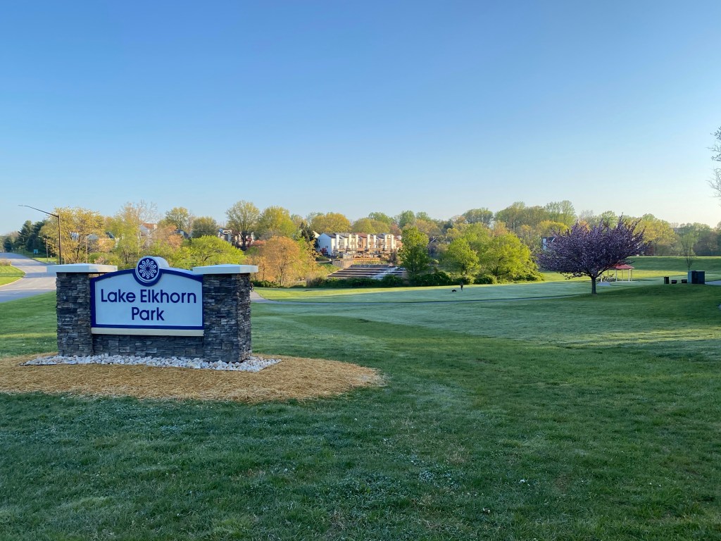
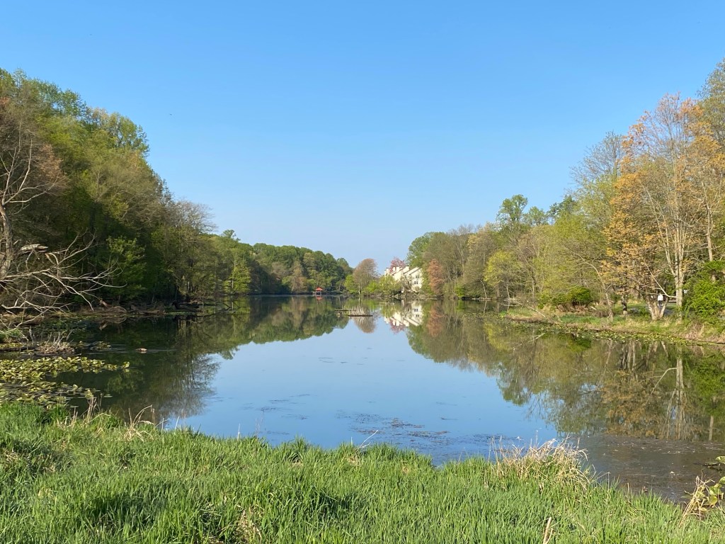
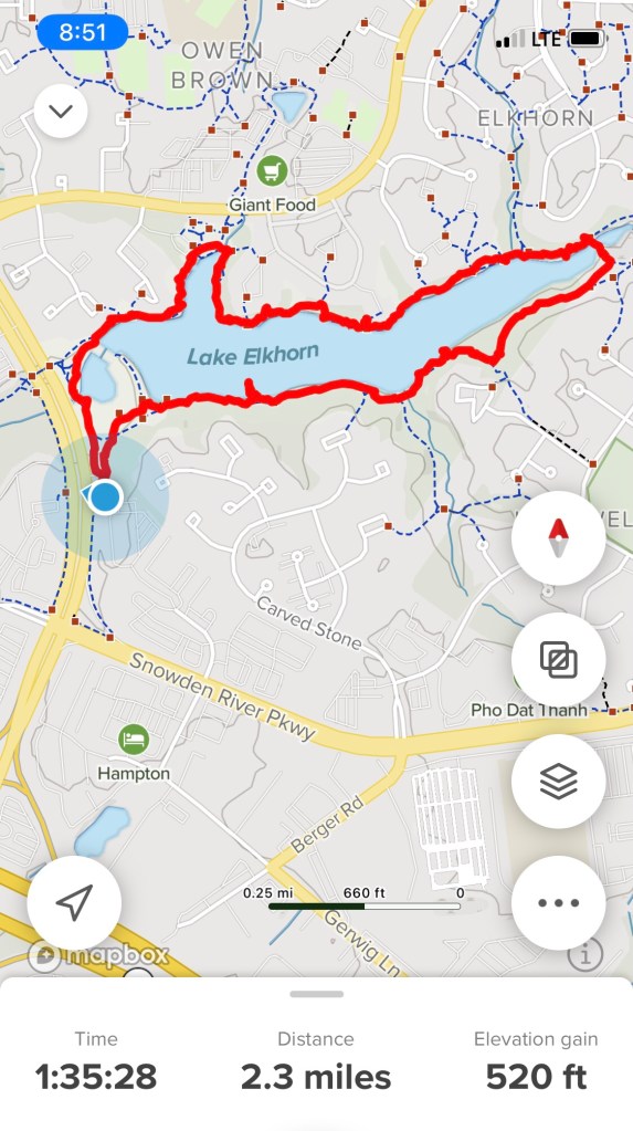
4/24/2021 West side, Parking lot A – Trail around the lake
Location: Broken Land Pkwy, Columbia, MD 21045
Elevation gain: 66ft
🧤
The weather hasn’t been kind to us on the weekends this year so our posts are scarce. Mostly rain or snow but freezing temperatures have been also sabotaging our longer hikes to explore new trails.
We walk at least 2 miles a day but I usually only blog about walks or hikes we haven’t done yet. I found today’s destination by chance last year and have been waiting for a decent day to check it out.
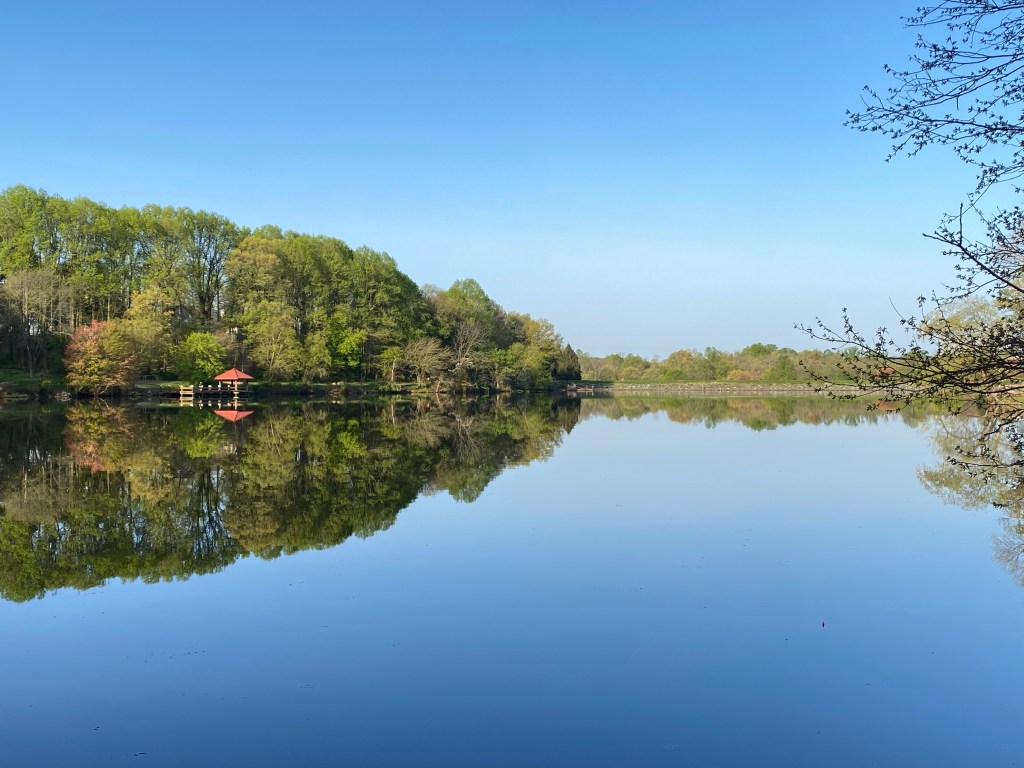
Lake Elkhorn is a 37 acre reservoir, Columbia’s third and largest lake. The path was built in ‘82 and is an easy and virtually elevation free paved trail.
I knew it could be crowded because of the close proximity to civilization so we got up at 6 am to get there around 7. Parking lot A is smallish – spaces for less than 30 cars – and I could not find a parking lot B. Last year I’ve parked in Hopewell Park on Rustling Leaf because the community pool was closed for the season. That could be parking lot B.
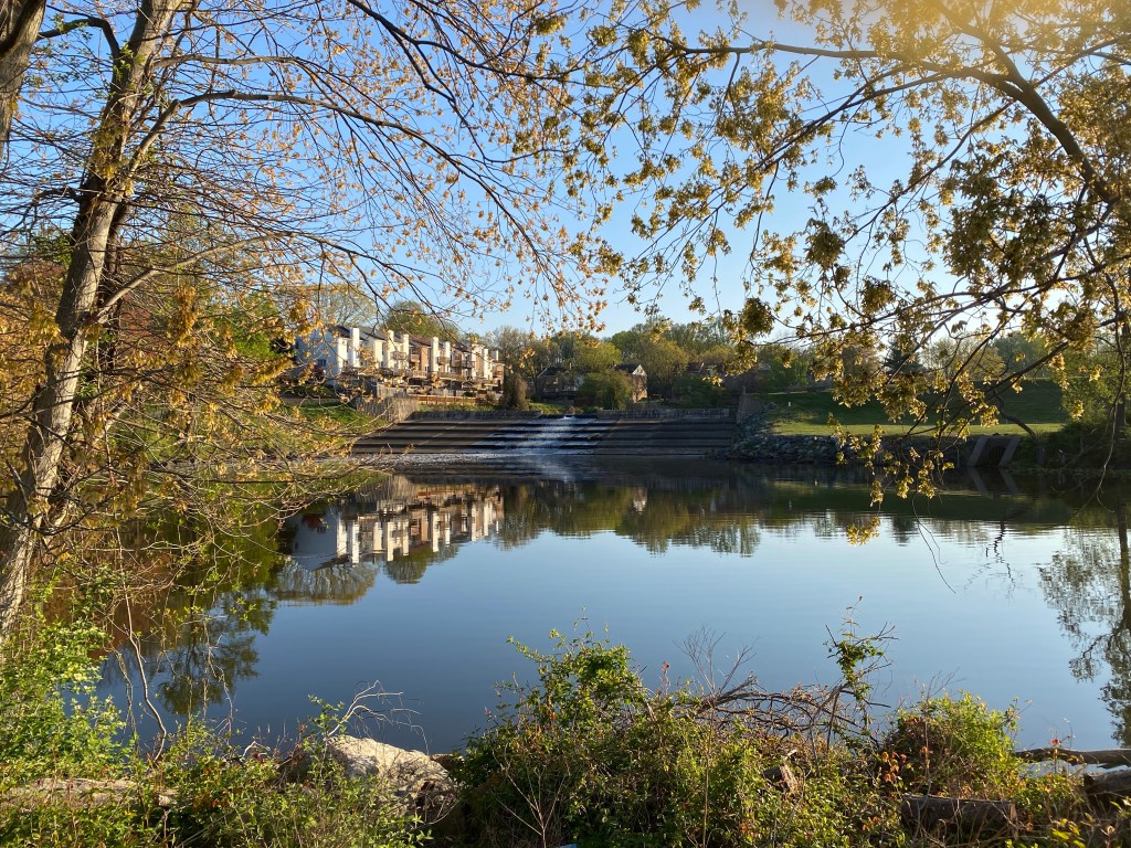
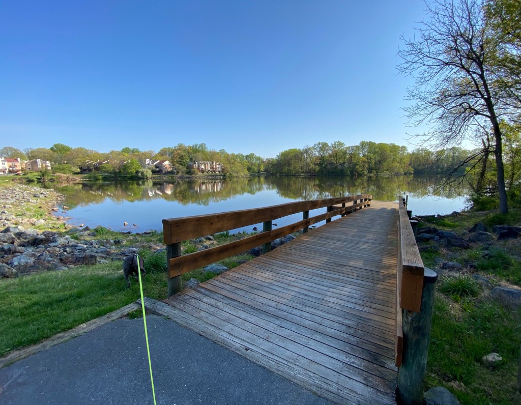
Even tho I don’t need a jacket this morning but gloves are a must since it’s still around 40 degrees. We are starting out on the north side of the lake following the trail clockwise. Our walk couldn’t start out more picturesque with Lake Elkhorn Dam on our right.
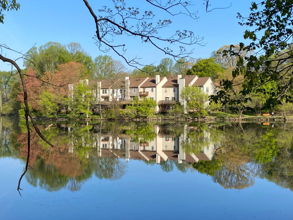
Even those townhouses couldn’t ruin the view. Crossing a beautiful wooden bridge is necessary since the tiny creek is in a hurry to join Little Patuxent River close by.
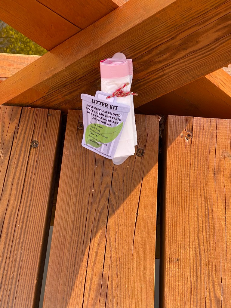
Since the park is extremely well maintained and clean, there are small litter kits on the bridge to encourage people to do their part in keeping it clean. It is obviously also dog friendly and I’ve seen several poop stations throughout the 2 mile trail.
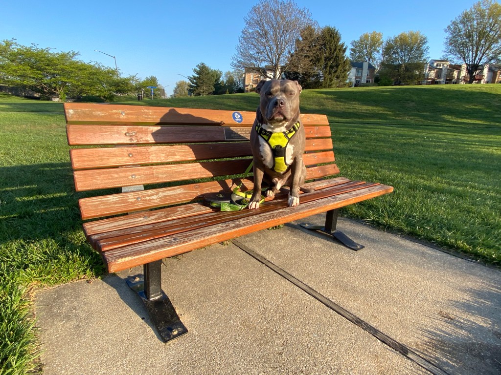
We couldn’t resist to one of the benches provided to sit and enjoy the view and to add to Mag’s benched series. He loves doing this (doesn’t show on this pic). All benches are dedicated in memory of people by family and friends.
Passing by the townhomes we take a minute on the lookout platform to spy on a pray bird. He is sitting on top of the fence on the other side of dam (too far to take pic). The view is gorgeous but the waking sun’s reflection ruins my take. Farther up the trail….
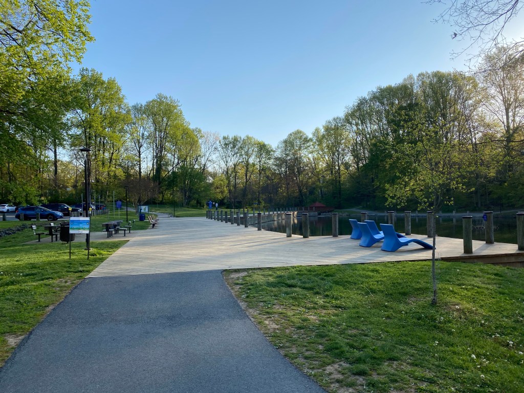
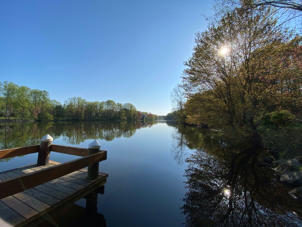
Lots of people are walking their dogs so we stop frequently and wait for them to pass. Mag has been behaving, I am very impressed that he left his Cujo side at home. From the dam to the wooden docks we walk right along the townhomes. I think I’ve just found parking lot B! There is another small parking area here. We could put our kayaks in, play chess or sunbathe.
Closer to the homes is a rain garden and up on the small hill a playground and off course fantastic views of the lake. Under the docks in the corner several “bubblers” moving the water to keep it healthy. Mag thinks they’re suspicious….
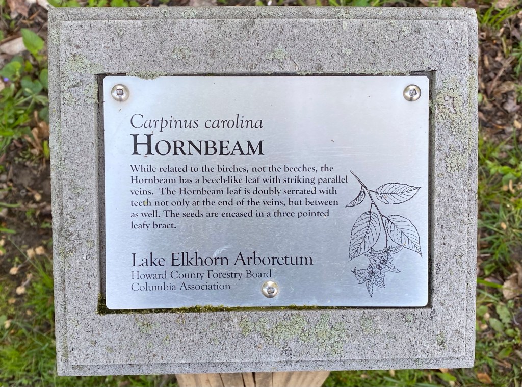
While the trail winds through a small wooded area, educating the passersby of the different species of trees….
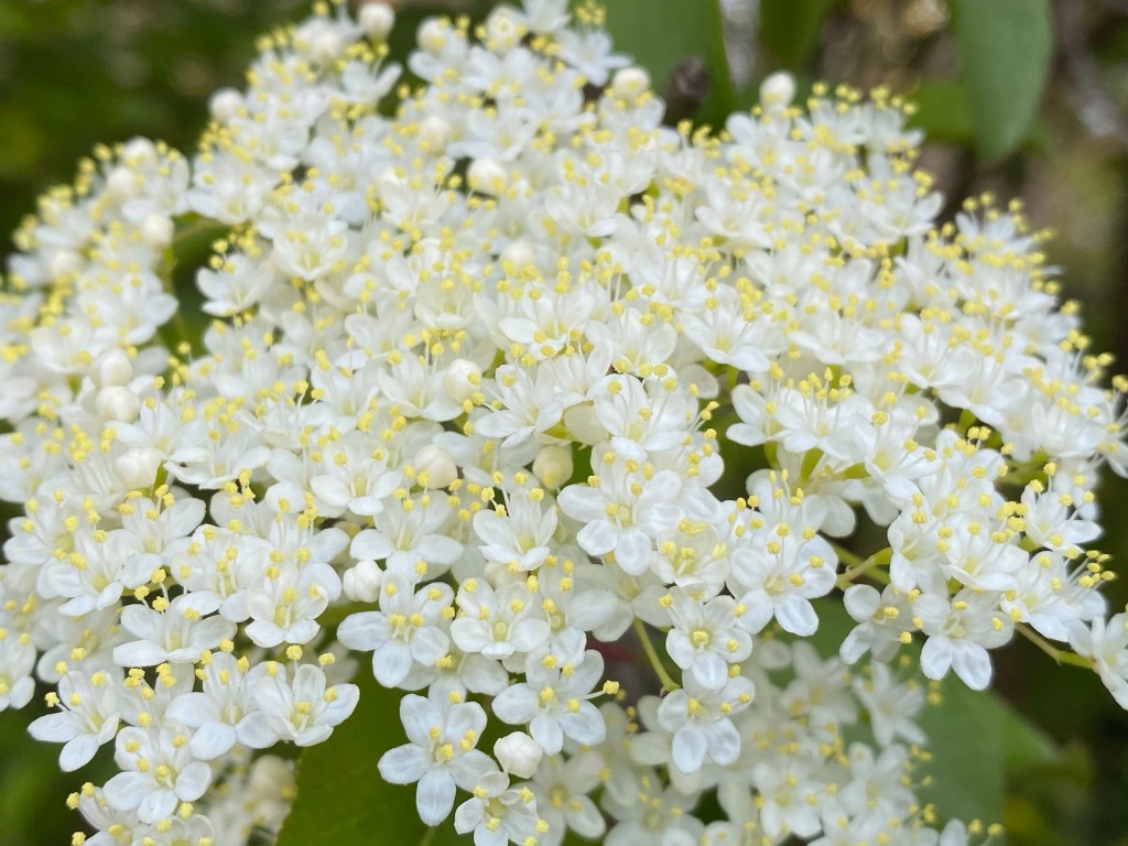
….we walk towards one of the covered lookouts. All the views are magnificent around here. Lots of trees and bushes are in bloom: dogwoods, blackhaws, honeysuckles, redbuds.
Blackhaw
People are walking, running, fishing but everything seems to have a slower pace. Time is standing still it seems.
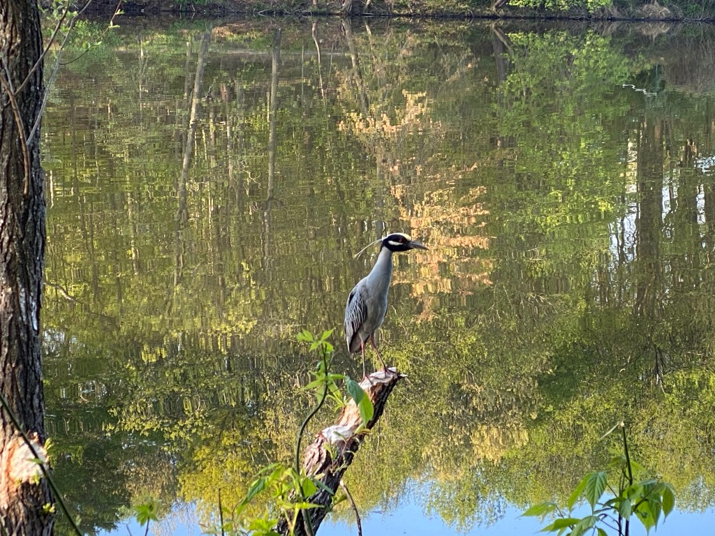
This gorgeous Gray Heron is sitting next to the path looking at Mag like “You are a weird grey heron, bud!” until a jogger scares him away.
I have been taking so many wonderful photos! I wish I could share them all. Here is just one. Just such an idyllic setting.
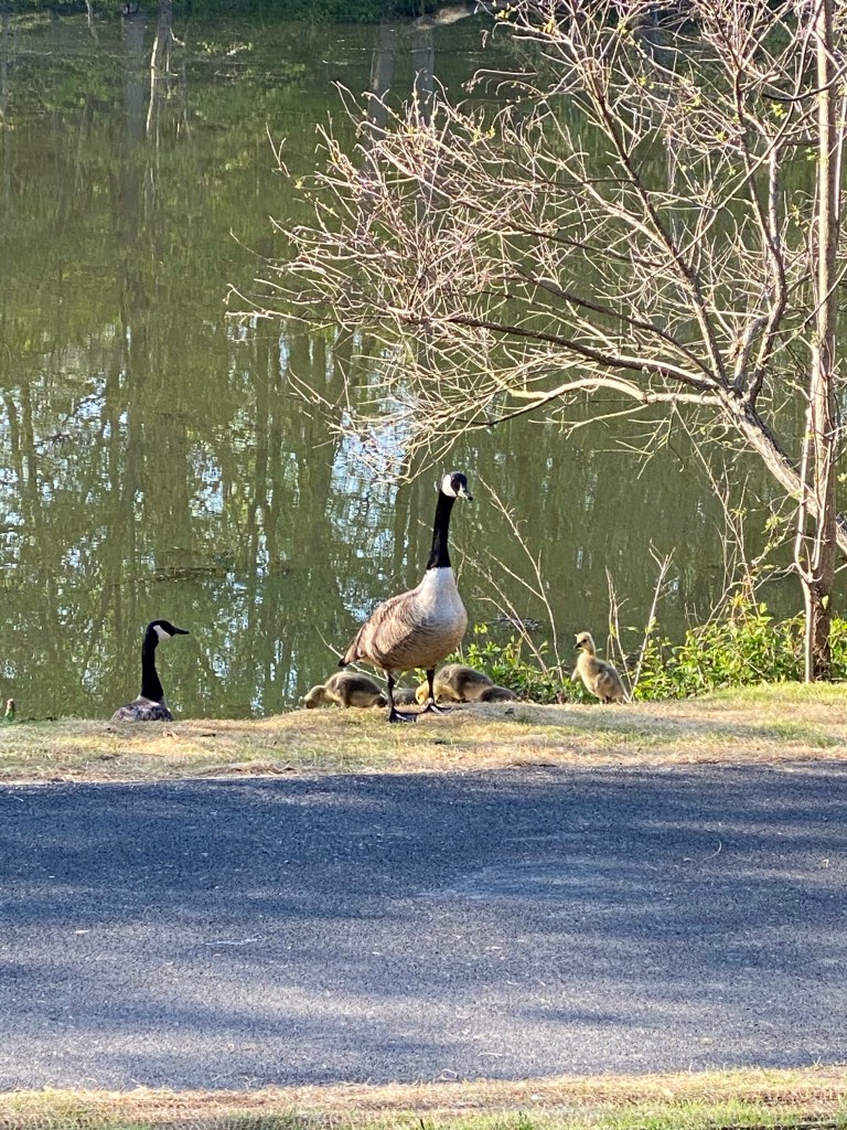
We even run into a Canada Geese family trotting across the path with 6 chicks! Dad is very protective off course. Soooo fluffy and cute! We circle around them even tho most people are less than six feet away from them on the paved path. I guess they are used to us.
At the east corner of the lake there are plenty of lily pads closer to shore but still no signs of frogs and other critters. We find another boat ramp than have to cross the second bridge over the swampier side and turn right to walk the south side, back to our starting point.
The trail runs just a bit farther from the water here, tall trees providing plenty of shade. All the way through, padded with mulch are exercise equipments to help keep us in shape.
There are tiny ‘fishermen paths’ still taking us down to the lake and I actually doubt that anyone could ever take a bad photograph here.
View of the townhomes
I am blown away by the beauty and serenity of this man made Lake! Kind of even feeling guilty to blog about it except that my blog is not too popular so it’ll be fine.
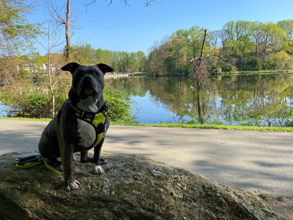
We are just enjoying this beautiful setting by sitting Mag up on a sizable boulder with the north docks in the background.
Did you say chikin?
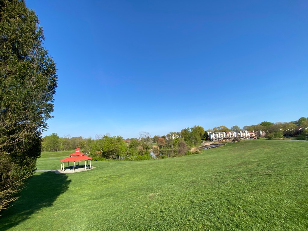
At the west side we cannot miss the main pavilion with a water fountain and a bike rack. It’s looking over a long kayak ramp/dock and the stony edge of the dam.
A smaller red roofed pavilion is sitting pretty on the bottom of the hill, inviting people from the parking area to sit and marvel.
Unfortunately we are at the end of this wonderfully beautiful walk. I am sure will be back to merge ourselves again into the beauty of Lake Elkhorn.
Here is our map:
P.S.: our little gourd houses are getting occupied again this year! Wrens are moving in…. and our first hummingbird of the season arrived on the 17th! Movies attached in a separate post.
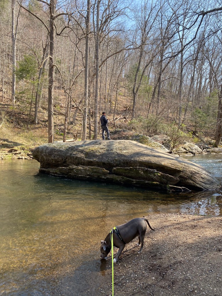
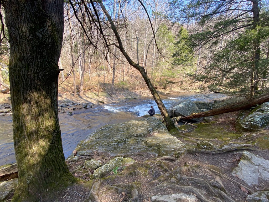
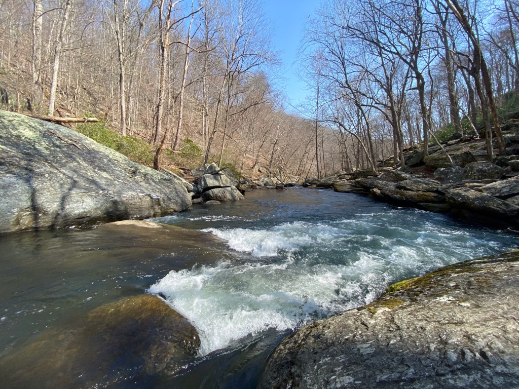
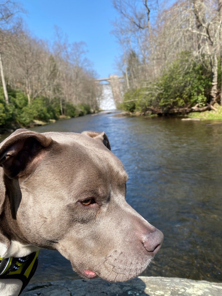
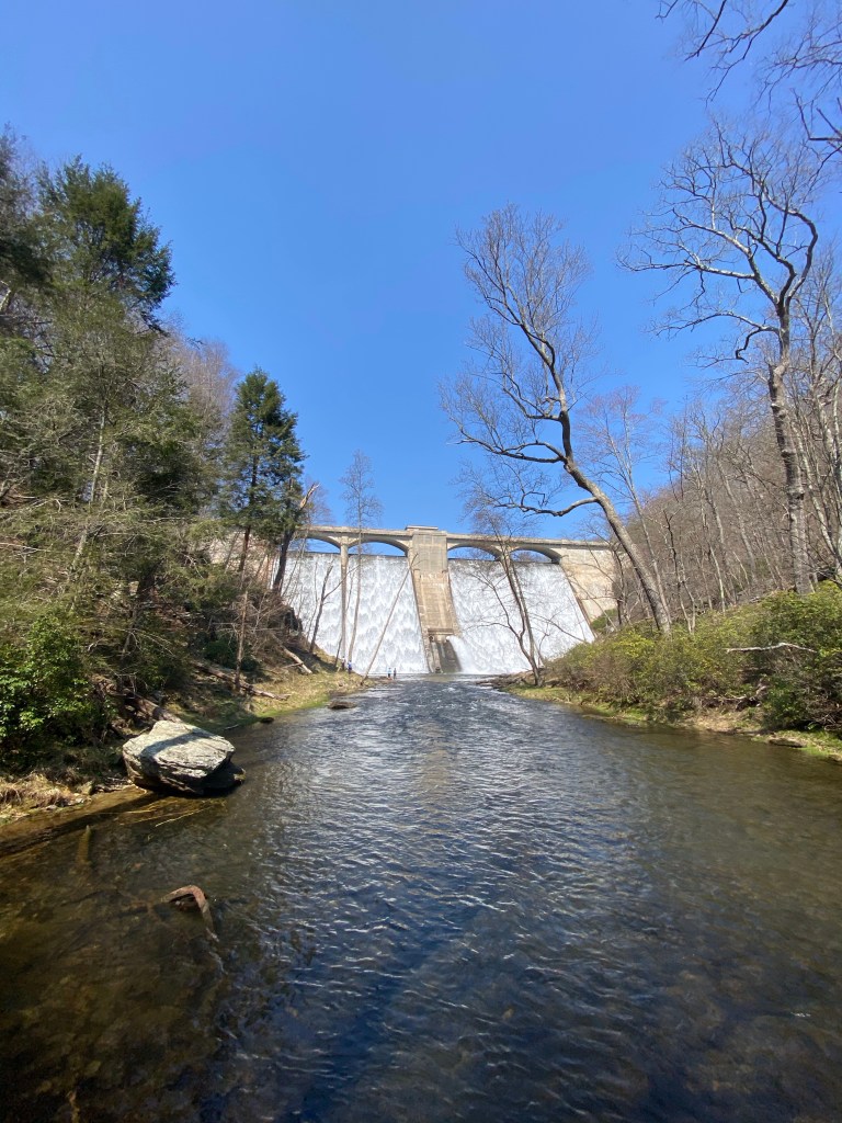
To celebrate MAG’s fifth birthday I convinced my hubby to come and hike with us in one of our favorite spots within Gunpowder Falls State Park (several earlier posts can be found if you look back). I was also trying to find my favorite pair of gloves “left hand” on a non existent trail we’ve hiked 3 months ago. Unfortunately I was unsuccessful but I hiked up to the dam while Mag and hubby waited for me on a boulder in the middle of the river. We’ve all had a blast even though we got a bit hot by the end. Temperature changes are significant from morning to the afternoon in the spring.
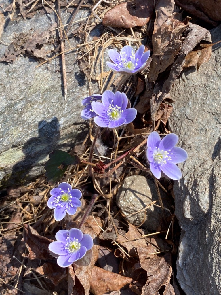
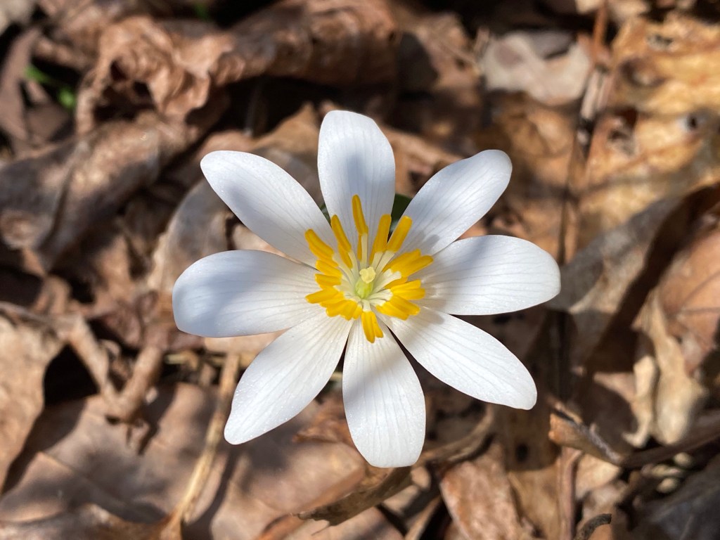
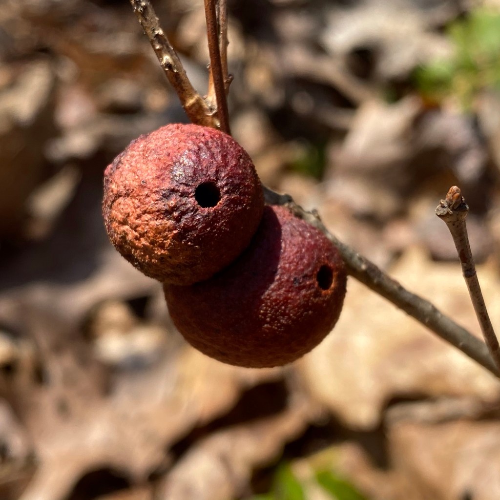
Gorgeous Gunpowder FallsWhale boulderA zen momentRapidsBirthday boyPrettyboy damRoundlobe HepaticaBloodrootAnyone knows what this is?“Barking up a tree” – Flickr acct Mag ZillaNeed to rest now!
Today is my 20th anniversary of arriving in the USA. Most women associate this date with International Women’s Day around the globe but for me it will always be the first day to my new beginning. Even tho it wasn’t my first time to set foot on American soil it was officially the last time as a Hungarian citizen.
My humble beginning started in New Hampshire but after three months I got transferred to a job where I mainly babysit English Bulldogs….Emily, Maddie and Woowoo, here in Baltimore. For an animal lover like me that is a dream job! I will never forget them!
I am also extremely grateful to Stephanie and Richard Johnston who took me in and trusted me. Actually thinking of them today made me write this post to see if it would be possible to find them….the web is pretty wild like that. They may be living in Arizona now.
I have met my husband of 18+ years through Stephanie and I had a pretty fabulous time looking after those #snorefactory-wrinkled-lazy-lovebugs.
It is pretty mind boggling that it has been twenty years. Sounds like an eternity. Since there are no do overs in life, I have no regrets.
Just wanted to say thank you to all who shaped my journey.
That’s all. Thank you for reading!
I dedicate this heART to Woowoo….
P.S.: I’ll work on two more hearts for Emily Mama and Maddie ❤️.
Have over 140 edited, collected in the past 2 years on our hikes. A changing selection of them as glass prints by Fracture are on display at out family business. Others are getting posted on FineArtAmerica continuously. Wish me luck!
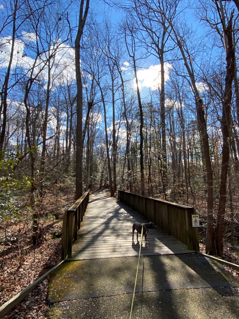
1/17/2021 Red Maple Pavilion – Bike path south – Wildwood trail – noname trail to beach – Harness Creek trail – shortcut to avoid people to two more beaches – Holly Pavilion heading back – Quiet Waters Park road – back to Bike path north – Red Maple Pavilion
Elevation gain: 180.4 ft
Location: 600 Quiet Waters Park rd. Annapolis, MD 21403
🐕
I have found this gem two years ago when we were looking for dog beaches. It’s a very popular, wonderful, dog friendly park with a designated small dog beach that can get super crowded in the summer.
On a day like this – in the dead of winter – it offers more space and less people. Even tho it’s colder than what my husband prefers, he came along with us. I will try to walk the whole perimeter of the park with him but will not hold my breath….
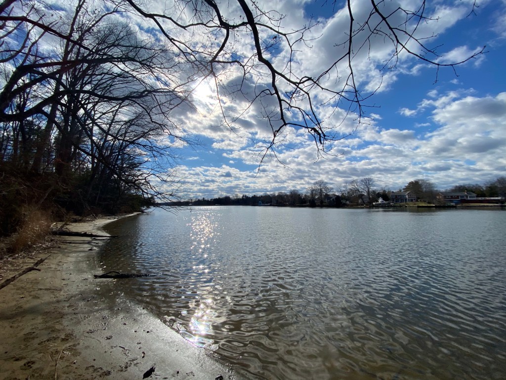
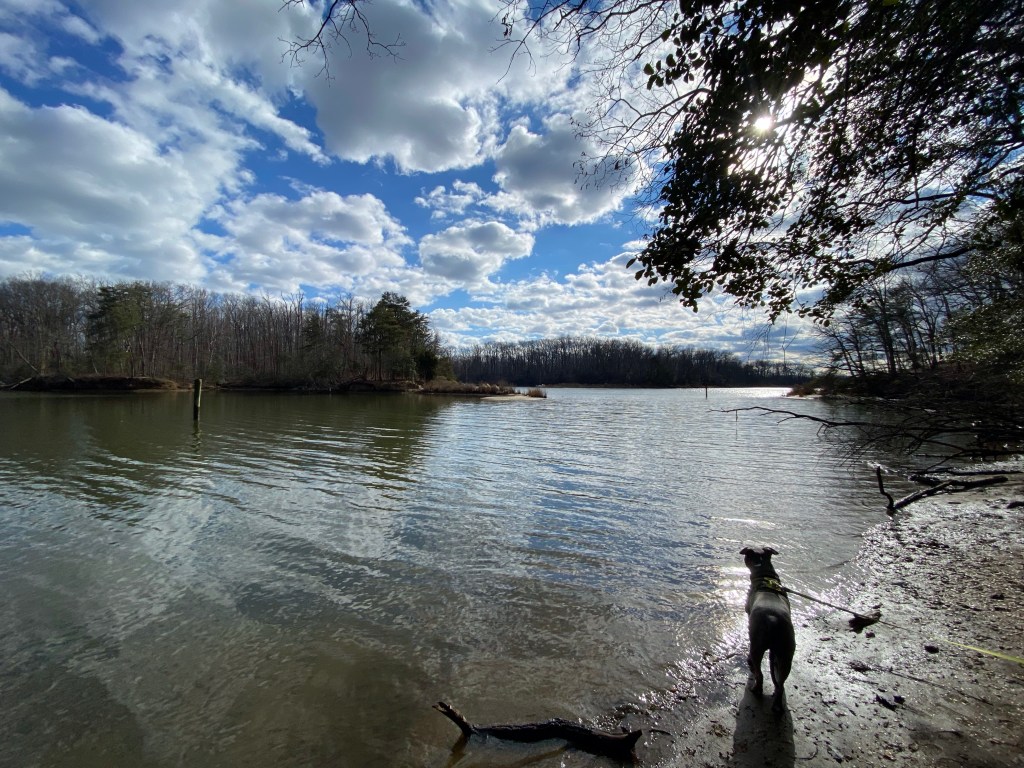
We are right on the Chesapeake Bay but a closer look reveals that the beaches are in Harness Creek that connects to South River.
We are starting out from one of the closest parking areas to the entrance. By the way this park has an entrance fee (few dollars). However it is kept clean with several large pavilions (Red Maple, Sycamore, White Oak, Dogwood, Holly), grilling opportunities, a Concert Stage, lots of picnic benches and small beaches.
Beautiful day if you ask me
The Bike Path is paved, however there are hiking trails beyond it, through the forest, closest to the water. Unfortunately we miss our first opportunity just before White Oak pavilion to make our loop longer and to enjoy the views of Old Pace Cove.
Have no fear, there is another cut off after the Blue Heron Center, called Wildwood Trail.
I’ve counted three small wooden bridges on the path crossing over teeny-tiny brooks. There are two educational displays as well, teaching about compost….one is here where we take Wildwood trail.
Look at this wonderful view at the end of the trail.
Harness Creek
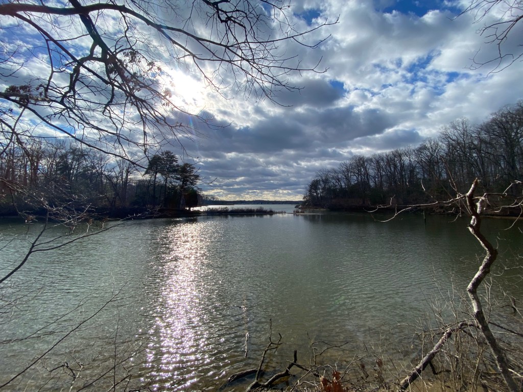
Continuing on Harness Creek trail would take us to the Boat Rental building but somehow it feels crowded so we cut through, cutting off about three tenths of a mile. We are rewarded with magical views.
Even tho I try to convince my hubby to take the time and walk down to the dog beach, we end up cutting our loop short. Instead of turning right to reach the southern most point of the park we turn left, heading towards the Visitor Center.
Turkey tail?, Sycamore love knot, Trout Lily leaf, Sweetgum pod
We also miss the nearby dog park, situated in the next turn heading towards the South River. However, we come across a few doggies while marching towards the small man made lake next to the main buildings. It’s a very relaxing and inviting atmosphere in nice weather we would sit on one of the benches to enjoy the sounds.
After catching back up to the Bike path on the right we continue north just enjoying our time here, walking slow. This also gives Mag plenty of opportunities to smell every living thing in his path.
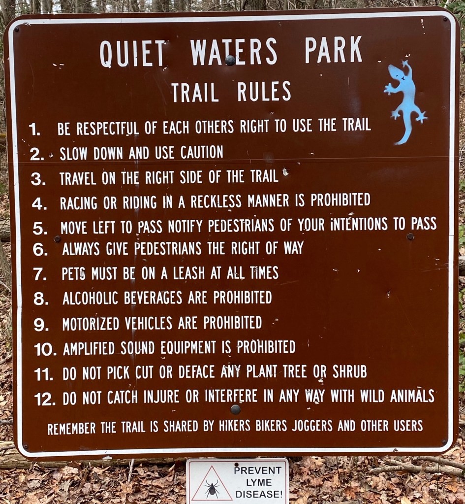
After passing the Gate house in the middle we stroll another three tenths of a mile to the very beginning of the park. The path loops back towards the south, taking us back to our starting point. Since this is the actual origin of the path the park’s rules are posted here.
In about a half a mile later we are back to our vehicle. Checking Mag for ticks is a must and we also make sure he is well hydrated.
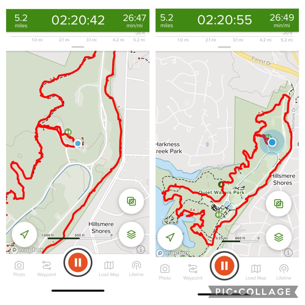
Here is our action map.
Driving home takes us about an hour and after picking up food Mag hits the snooze button. Rest well deserved!
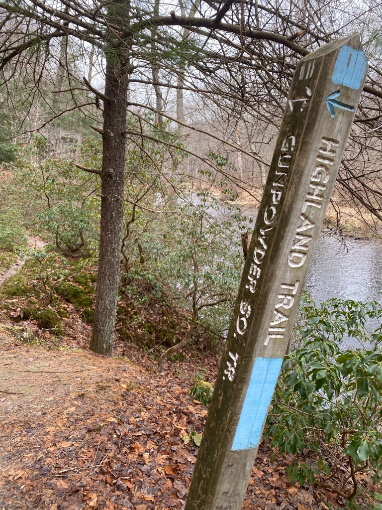
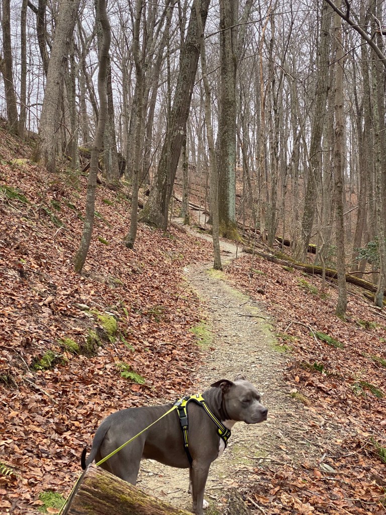
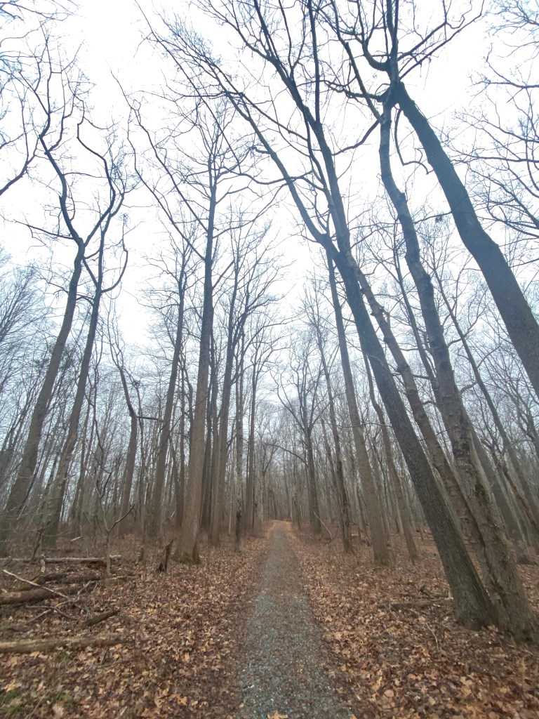
1/1/2021 Gunpowder South Trail (white) – Highland Trail – Gunpowder South Trail – track back
Elevation gain: 745ft
Location: small parking area is on Masemore rd. but there additional street side parking up and down the road
17701 Masemore rd. Parkton, MD 21120
☔️
This trails is one of my all time favorite. (There is another post about this back in 9/8/2019.)
(FYI : there are two more trails on the other side of the road.)
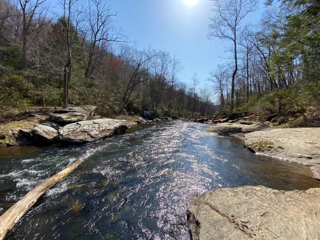
The scenery of the river is absolutely beautiful! Today suppose to rain but I am being optimistic to make it back before it starts (weather will prove me wrong). I am not sure who made this sign when getting on the trail….
….but it doesn’t reflect the actual name of the trail. Be careful when next to river, this path is narrow and slippery when wet. I’ve planned to head up all the way to the dam following the Gunpowder but changed my mind thinking I want to enjoy the river’s beauty on the way back. So we are leaving this trail to jump on Highland Trial heading West.
Slight uphill from here to reach the ridge for about a half a mile….
….then downhill again through an abrupt direction change while jumping over a tiny creek. Uphill again until we reach the power lines where winter is more visible thanks to windier conditions.
From here we continue on a spacious excess road, covered in some sort of black gravel.
Less then a half mile later we would cross Falls Rd. but since AllTrails shows 2 more possible trails to our left we go to investigate. I would love to add the “promised” 1.2 miles but after wasting 20 minutes looking for the none existing paths we head back to Highland Trail. We shortly reach the intersection of Gunpowder South where we turn left staying on the ridge. View of the river is peeking through the woods.
In a quarter of a mile after descending again we skip and hop over a small creek feeding into Gunpowder. The terrain is sort of challenging through the downhill and on both sides of the brook.
Mag is visible on the bottom 😉
Several small rapids pepper the creek, along with funky looking small Pear-shaped puffball fungi.
We turning left again when reaching the river, continue on Fisherman’s Trail. There are lots of spots to take a break and enjoy the water while heading North towards Prettyboy Dam. It’s less than 0.5 mile away and is clearly visible.
Are we there yet?
On our left the hillside is mostly invisible thanks to the densely grown evergreen Mountain Laurel. The leaves resembling those of Rhododendrons and in only extreme cold or drought would they fall off. I absolutely love the small parachute looking flowers in the spring.
The dam is getting closer as the falling water’s sound is getting louder. Even in this dreary weather the scenery is magical.
By the time we get to the dam it’s starts drizzling. Not a good sign considering that it’s cold as well. I have nothing to cover Mag with so after taking several shots of the dam I make a quick plan to head back.
I don’t know about you mom….
Fastest way seems to be to hike up next to the dam’s lookout – it is car accessible through Prettyboy Dam road – and quickly catch up to Gunpowder South trail through the forest.
Not recommending! By the time I actually realize that the trail is none existent it’s too late to turn back. We tumble around fallen trees and autumn leaves while slowly descend back towards the river. When we finally closing in on it I also realize that those densely grown Mountain Laurels are impossible to get through. There are a couple of other crazy people a few feet from us but we cannot reach to them. Dang. Spending another 20 minutes finding a clearing at least provides me with a photo opportunity.
We are finally back on the trail, moving as fast as possible. Cannot ignore this amazing setting tho, I snap one more pic.
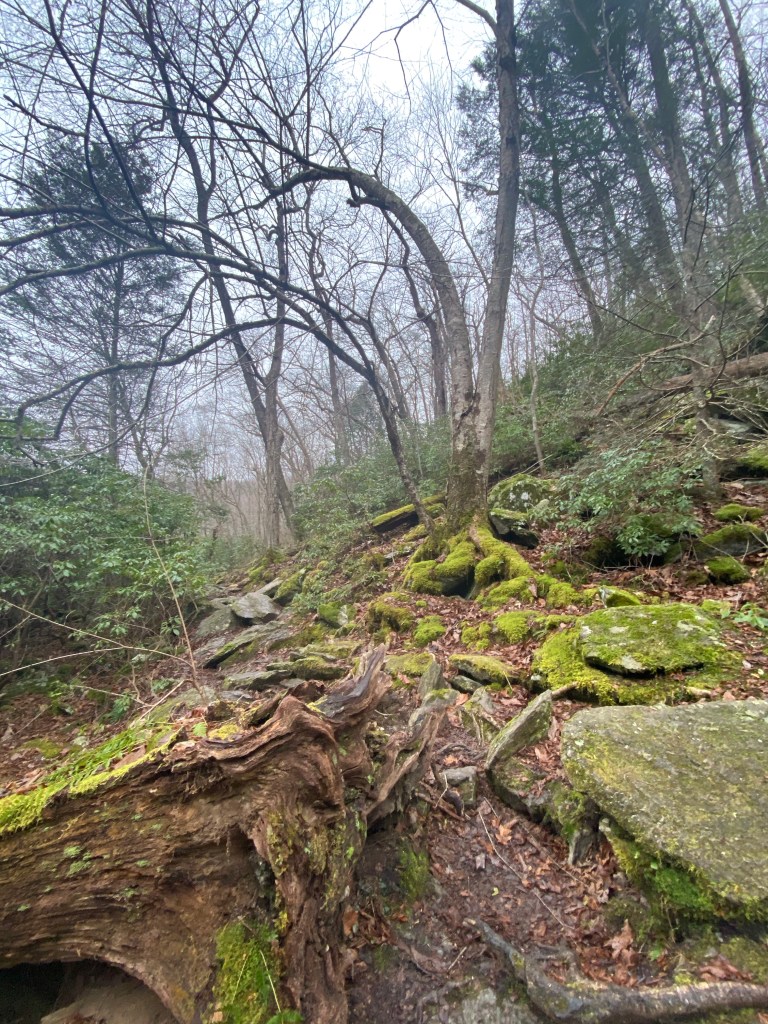
By the time we reach the second crossing at Gunpowder South it’s starts raining for real. Following Fisherman’s trail would put us in danger I feel since the temperature is close to freezing. Deciding on run-hike back up where we came from following the white trail, through Falls road and the power line clearing, down and back up on Highland trail.
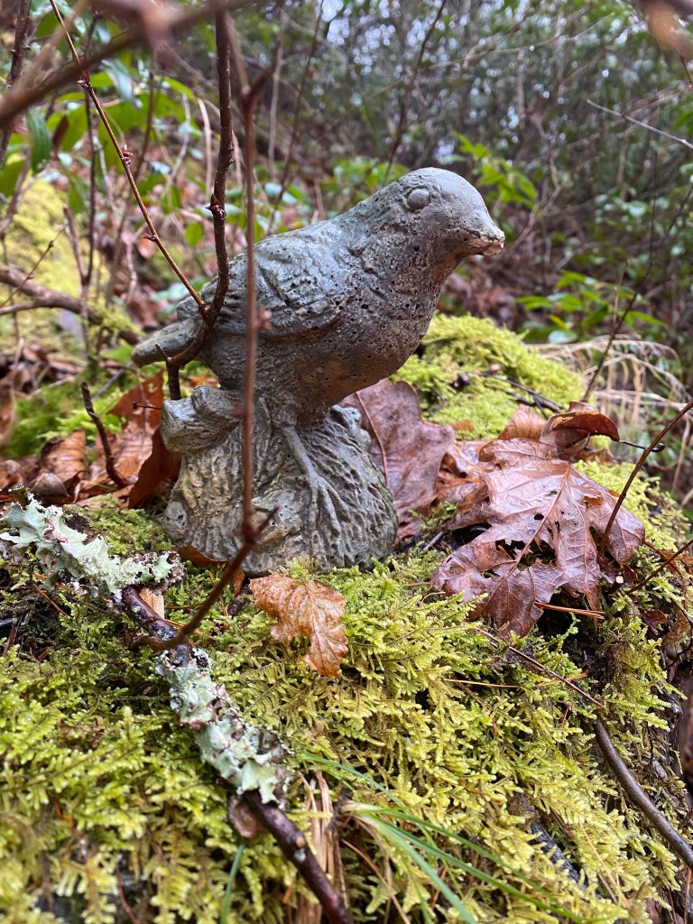
I am at least glad that I am in semi fit shape. We make it back considering the circumstances pretty fast, even running into another misanthrope girl on our way., heading the opposite direction. I also would very much enjoy being out here by myself if not for worrying for Mag. At the crossing of Fisherman’s trail I spy this little ceramic bird tucked away in the bushes.
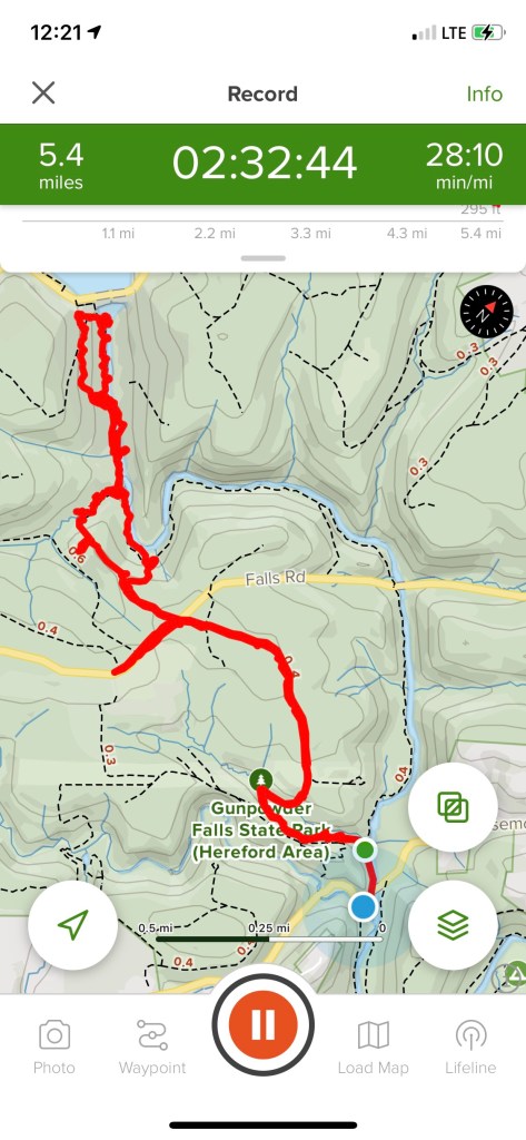
In a few more minutes we are back at our car – her name is Icicle….coincidence? – but still have to be careful since the parking area is an ice rink. Drying Mag is a priority then de-icing the car and finally documenting our hike.
While we get warm sitting inside our vehicle a family of four pulls up with a dog in tow. They spend about two minutes in the freezing rain trying to find a trail then decide to retreat back in the car against the dog’s will. And I thought I was crazy….
On the bright side….supposedly I’ve burnt 1300 calories! Starving tho. Let’s go home and have some lunch.
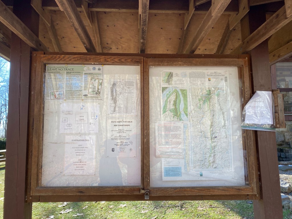
12/27/2020 Appalachian Trail Spur – Appalachian Trail – View lookout – AT for a small bit – track back through Rindt Trail
Elevation gain: 620.1 ft
Location: 34899 Appalachian Trail Rd., Round Hill, VA 20141
🥶
It is a very loooooong (I would say 1 mile) drive to the trailhead from Woodgrove Rd., uphill from half way….thankfully all of us drive 4×4 cars. It’s a cold day with ice forming on the creek’s surface running next to the road. I am just glad the winding route is not icy. Even without wintery conditions, letting on-coming traffic go is interesting, to say the least.
Since the trailhead is a well kept secret the parking is tiny. Actual spaces are for about 6 cars/trucks but a few more can be squeezed around with sensibility. We brought the crowds I guess because by the time we park and get out, the small lot is full already. A few more cars pulling up behind us.
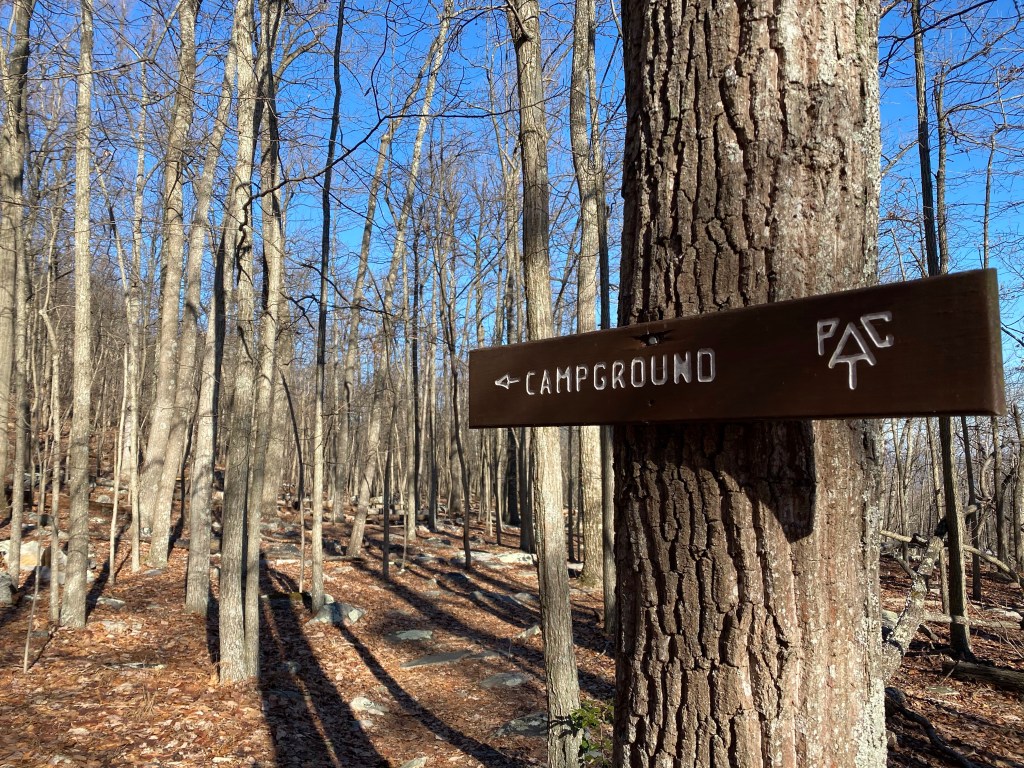
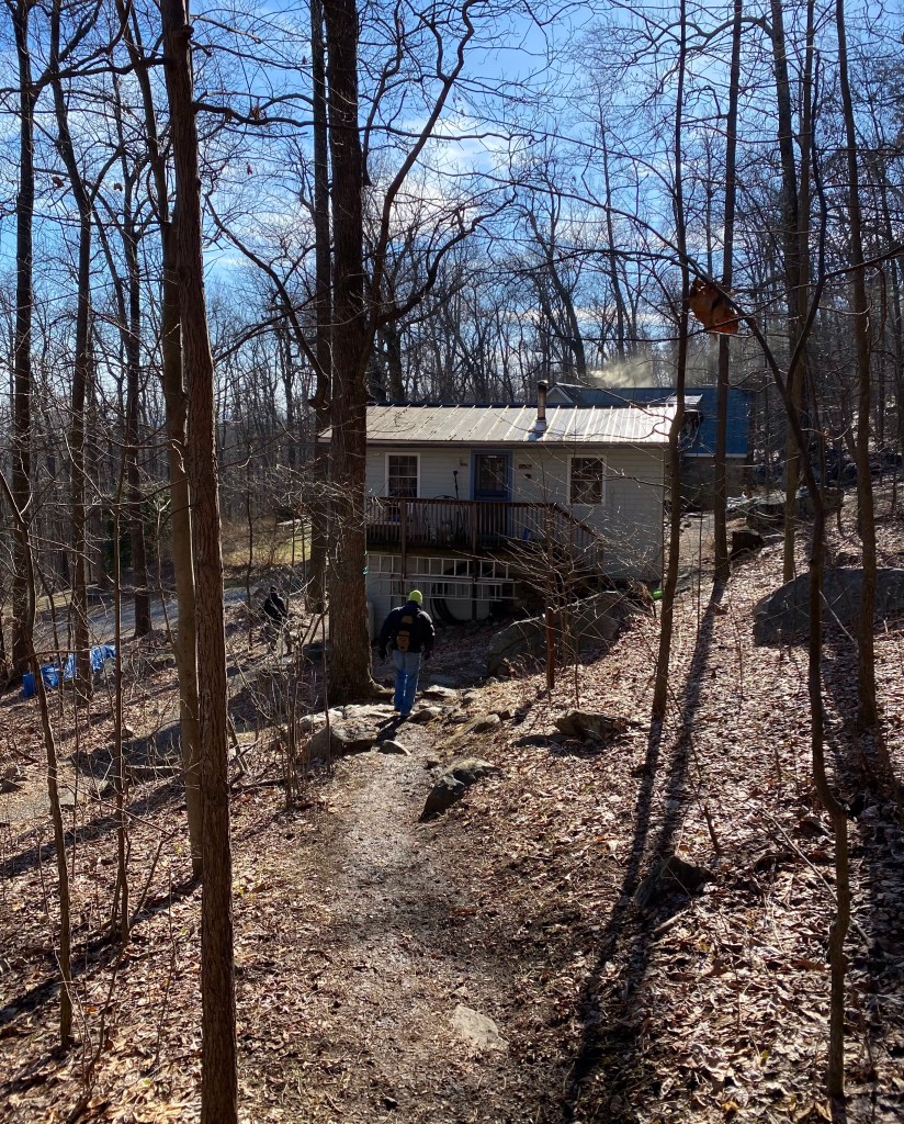
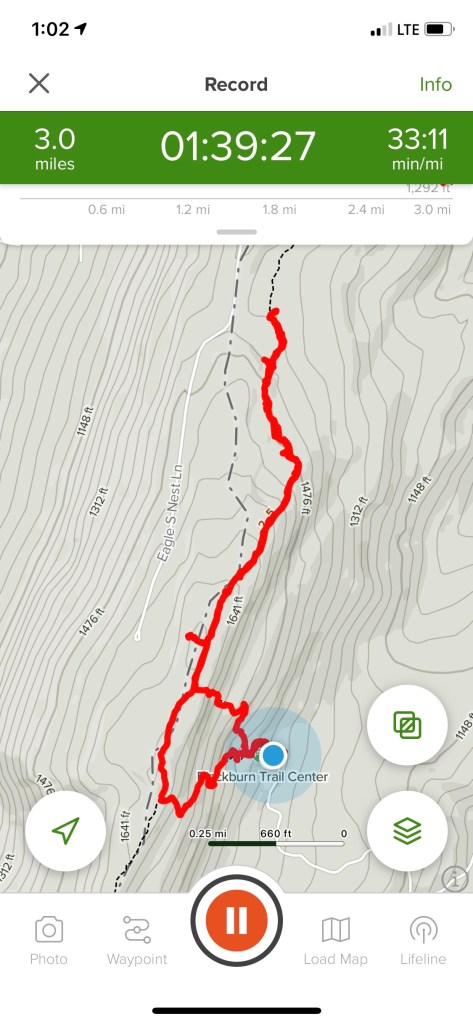
Uphill hiking starts or rather continues from our cars, passing Blackburn Trail Center.
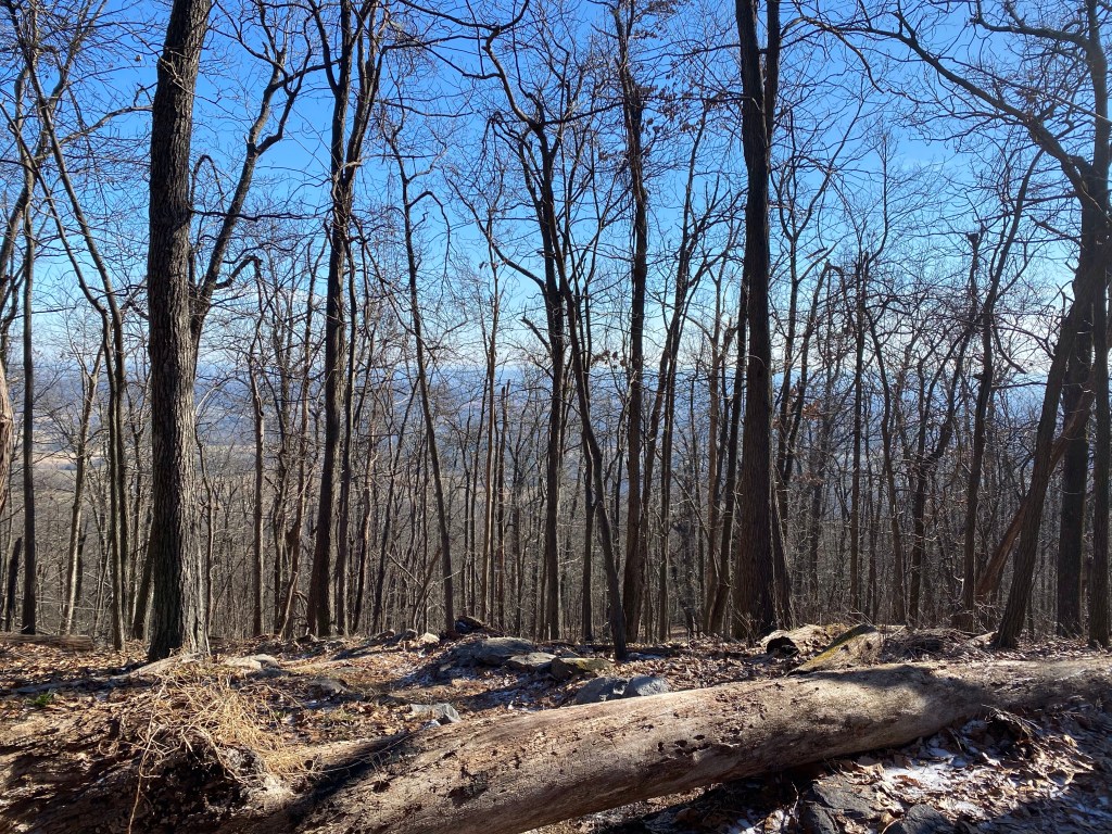
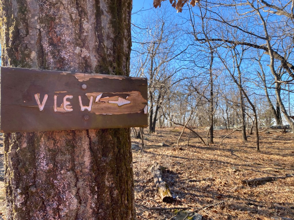
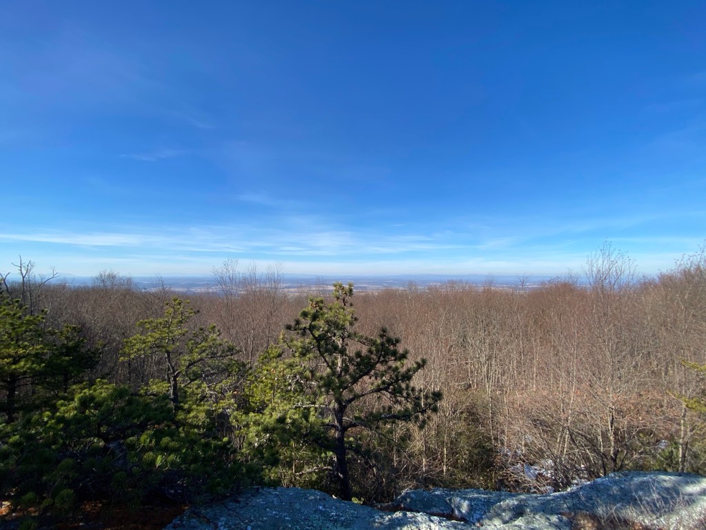
A nice couple actually resides here and just getting home. We stop to exchange a few words then head up the stone steps. Up on top is a partially covered view awaits us of the valley below.
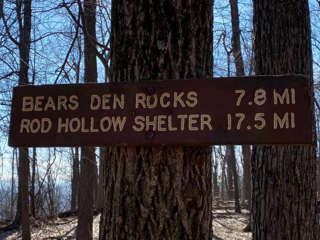
We are on the Appalachian Trail now, bordering West Virginia (white trail).
Signs are informing us of the possible routs we could take. Since we have company today I just make a mental note….
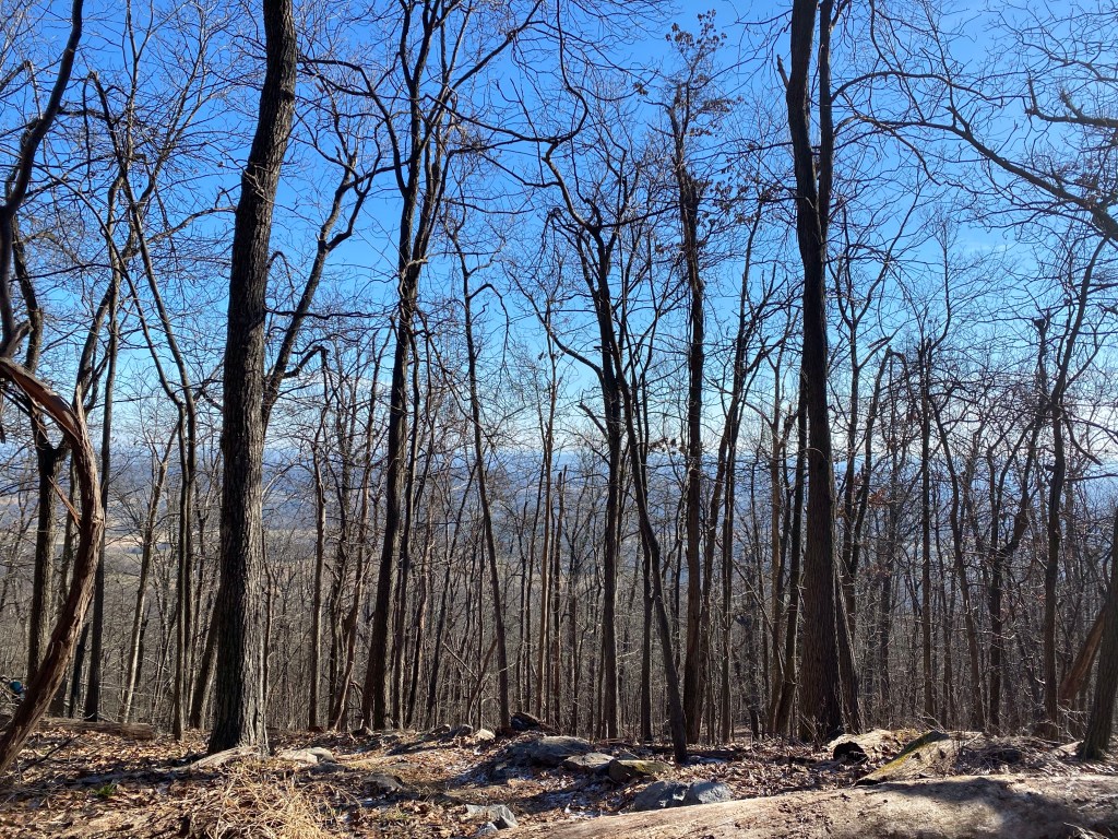
Up on the ridge there is no elevation until we leave the lookout. The view is of the NW Shenandoah River snaking just below the tree line.
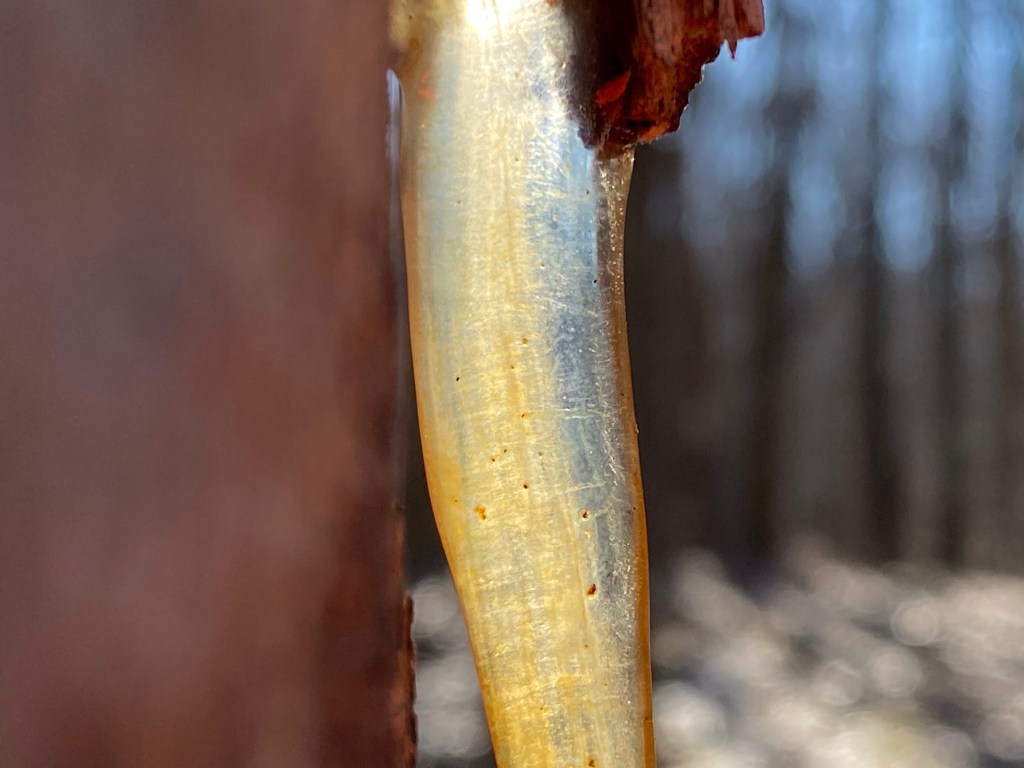
After getting back on the main trail we head North for less then a mile on a descending path. Since the woods are dormant there is not a lot to see but I still get a glimpse of this cool looking sap.
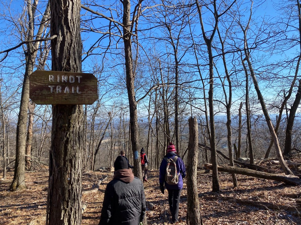
At one point we turn around to head back unfortunately. At least it’s now a slight uphill so we still get our recommended exercise. We taking the first lefty – Rindt trail – back towards the campground.
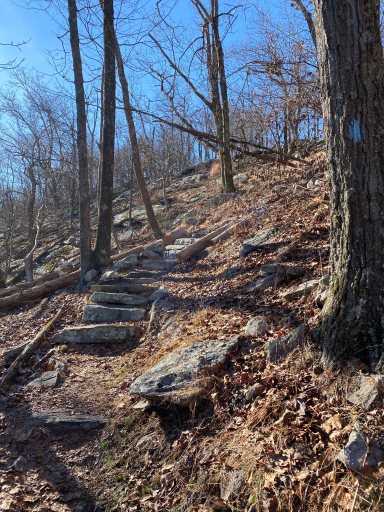
I am not a fan of downhill hiking but here thankfully natural stone steps lining the way making our march easier. Definitely better for my knees.
There several elevated platforms built here for tents.
We are back at our cars in a jiffy. This was really a shortish hike for us but we are still very happy to get out at least.